Clean Victor options at first, then a decent swell for the Mid and South Coasts Thursday
South Australian Surf Forecast by Ben Matson (issued Monday 23rd May)
Best Days: Tues/early Wed: good clean surf at Victor. Thurs: light variable winds and a decent combo of swells for the Mid Coast and South Coast.
Recap: Rapidly easing but clean surf over the weekend with strengthening offshore winds - plenty of good options at Victor, especially on Saturday. Today we’ve seen a bumpy 2-3ft stormy on the Mid Coast and clean 3ft+ surf at a Victor (see recent surfcam grabs below) under a W’ly tending W/NW breeze.

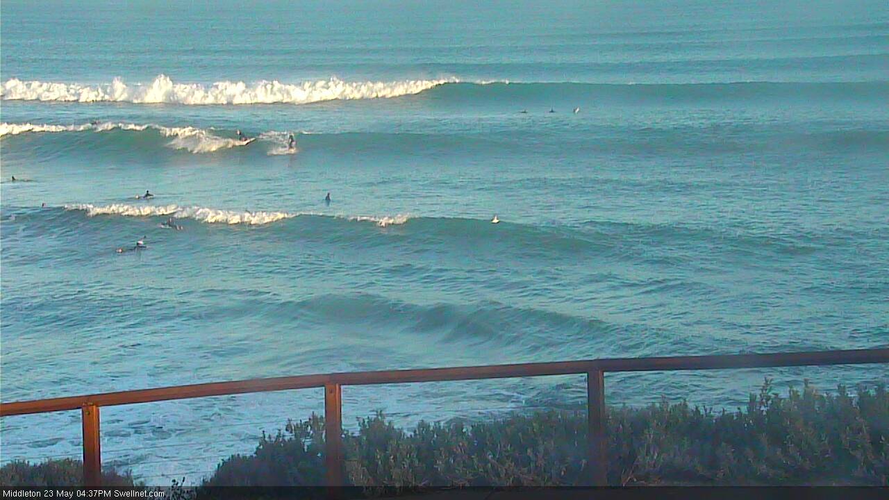
Middleton this afternoon - full and fat as per usual, but some reasonable sized lines of groundswell
This week (May 24th - 27th)
I’m reasonably happy with my call to downplay Friday's computer model’s estimate for 4ft Middleton today; it’s not far off but is certainly closer to 3ft. As such, with the models estimating a further slight increase throughout today and overnight, I’m keeping my expectations pegged a little lower as I think they’re still overcalling the surf size.
Nevertheless, Tuesday and Wednesday are looking excellent for the Victor stretch with light NW winds all day tomorrow expected to freshen on Wednesday as a front clips the coast later in the afternoon. Surf size should peak overnight tonight with Tuesday offering inconsistent early 3ft+ sets at Middleton in the morning, down to 2-3ft by the afternoon, trending smaller throughout Wednesday (probably better suited to Waits and Parsons by this time).
On the Mid Coast, these freshening NW winds will bump up an otherwise reasonable but easing swell to begin with. Early Tuesday morning will be the best time for a wave with reasonably clean - if a little lumpy - 2ft+ leftovers, with the norwester picking up a little into the afternoon, maybe even tending N’ly. Smaller waves (1ft+) and gusty N’ly tending NW will write off most of Wednesday’s surf potential.
Thursday still looks really interesting for the the South Australian coast. And, we’ve had a slight upgrade since Friday’s notes were prepared.
Last week I mentioned the possibility for an ‘unusual’ W/NW swell event originating from a pre-frontal NW airstream developing just SW of West Oz today. The good news is that this swell is still on target; the better news is that the trailing front has been strengthened in the latest model runs.
It’s not ideally positioned for the state - a low is expected to form along the frontal boundary tomorrow (south of WA) and then slip slowly southwards, still at some distance from the coast - but despite the unfavourable storm track, we are looking at a reasonable fetch developing in the swell window for 24-30 hours. And it's expected to display very strong winds too.
The funky W/NW swell (which will actually arrive from the W or W/SW in South Australian waters) is expected to push through later Wednesday - probably too late to be visually observed on the Mid or South Coasts - with slightly longer period W/SW groundswell from the primary low arriving early Thursday morning, building throughout the day.
And the other good news is that we’re expecting a weak troughy pattern across the coast, resulting in mainly light variable winds. So surface conditions won’t be perfect but they’ll be pretty good.
I’m expecting the Mid Coast to produce 2-3ft surf throughout the day on Thursday (mainly into the afternoon), and Victor should see anywhere between 3ft and 5ft surf at Middleton thru’ Day Street by the afternoon, with small clean waves at Chiton (the west component in the swell direction once again limiting options here).
You’ll have to make the most of Thursday as another small but rapidly moving front is then expected to reach the coast on Friday morning, bringing NW tending W/SW gales throughout the day.
It’ll kick up a small stormy for the Mid Coast by the afternoon (2-3ft+, dependent on wind strength and timing) but Victor won’t be quite as well aligned, so the surf will consist of easing groundswell from Thursday and a small increase in new W/SW swell. With strong winds this coast probably won’t be worth the drive from the big smoke - but let’s wait and see if Wednesday’s updated model runs open up the brief window of NW winds in the morning for a little longer.
This weekend (Saturday 28th - Sunday 29th)
More fronts on the way!
Actually, the weekend surf forecast is a little mixed. Friday’s windy combo of onshores and choppy surf will abate into Saturday morning but another front is expected to approach from the west, potentially freshening NW winds into the afternoon.
So the morning should have lumpy leftovers on the Mid Coast (2ft+) with similarly lumpy, but bigger waves at Victor Harbour (3ft+ Middleton).
On Sunday the approaching front will probably bring yet another westerly change and a late kick in new swell though no great size is expected, as the storm producing the swell doesn’t look very consolidated. Still, it’s an active time ahead and it looks like there’ll be waves across both coasts, both days. That’s always a positive!
Next week (Monday 30th onwards)
No major systems on the boil for next week at this stage, but that being said, we are expecting a continuing active Southern Ocean pattern or fronts and lows that should maintain plenty of surfable action right through next week. No major size is likely - at this stage - but we should see more than a few rideable days across both coasts.


Comments
Couple of other surfcam grabs - Suicides showing some nice lines, and the Bay with a bowl on the inside! This bloke caught behind the whitewater.
Super west swell angle going on thats for sure , from this pattern . hows the wind looking on thurs some models say light west . Craig are u getting waves mate ?