More of the same - but a tiny trickle for the Mid?
South Australian Surf Forecast by Ben Matson (issued Friday 30th January)
Best Days: No great days due to regionally small swells and persistent SE winds. Low confidence for a tiny line on the Mid over the weekend but unlikely to be anything truly worthwhile (if it happens at all).
Recap: South-east winds and small swells have really kept a lid on surf prospects over the last few days. Summer, eh?
This weekend (Jan 31 - Feb 1)
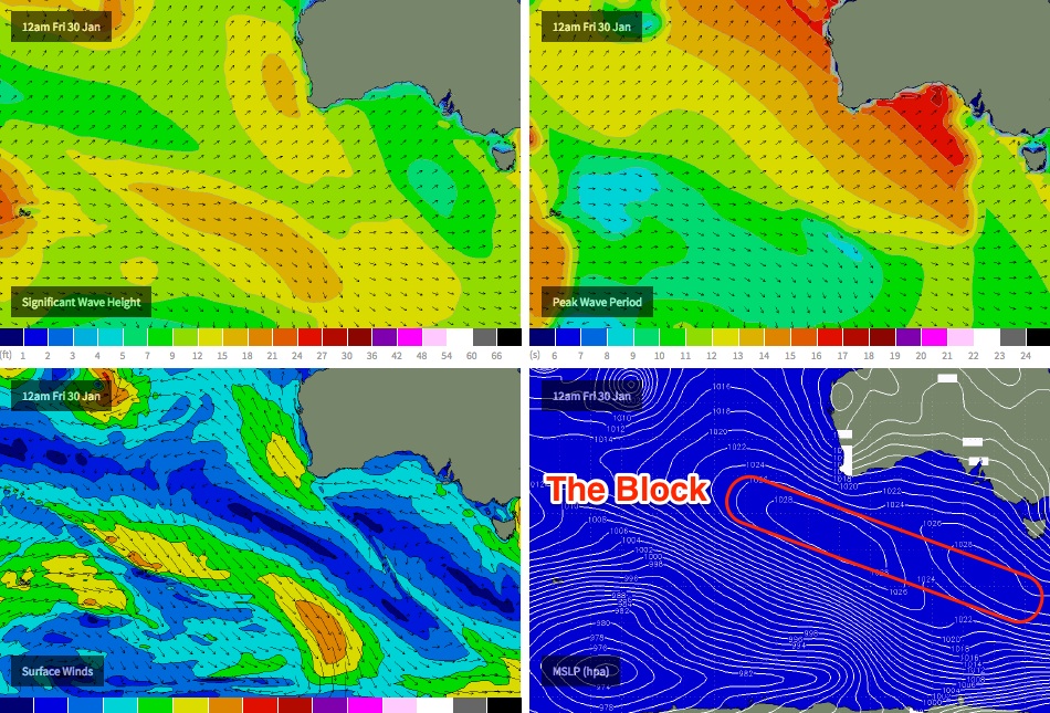
There are two compounding factors working against the weekend surf forecast: (1) a deep low in the south-western Tasman Sea, which - in conjunction with a large high in the Bight - is driving south-easterly winds about the South Australian coast, and (2) the high in the Bight, which is a slow moving, blocking feature (see chart below) extending from south of Tasmania up into the southern Indian Ocean, which has consequently deflected significant storm activity away from our swell window over the last few days.
So, expected more small summer mush at Victor Harbor.
On the Mid Coast, I’m unwilling to completely write off the small long range groundswell due to arrive sometime today (which was expected to peak on Saturday), simply because we don’t yet have any observational data on it.
If the leading edge had arrived and there was still no visible energy at the coast, it’d be possible to make a more qualified decision but this swell could simply be lagging a half-day behind (which is not unreasonable, given that it was generated many thousands of kilometres away from the mainland).
In any case, if it does arrive - and it’s a big if - it’ll probably peak sometime on Saturday afternoon, with an easing trend into Sunday. Don’t expect much more than inconsistent 1ft+ lines at most on Saturday, with very small waves expected through Sunday.
But remember.. it’s the Mid, so don’t turn your back for too long. The tide can do wondrous things with small, incidental summer swells. It’ll be worth a quick surfcam check every hour or so (if the CdC buoy shows anything of note, of course).
Next week (Feb 2 onwards)
This pesky blocking high will continue to steer storms outside of our swell window for some time, and will also maintain south-east winds across the Victor stretch for much of next week.
This means we’ve got another extended period of crapola on the cards down south, and without any new groundswell we can expect tiny to flat conditions to persistent across the Mid all week.
The only area of interest for me is a pair of tropical systems way out east of Madagascar (Severe Tropical Cyclone Eunice, and Tropical Storm Diamondra), which are expected to track slowly south-east, and eventually become absorbed into the low latitude westerly flow beneath the continent.
Right now the models aren’t showing much for the long term, but these scenarios often have a habit of becoming rather dynamic - so I’d flag an outside possibility for a significant swell event sometime around next weekend. Otherwise, break out the fishing rod.
Let’s take another pass on Monday to see how the long term models are looking.


