Moderate southerly swell pulses, very slow start to next week
Nias, Mentawai, South Sumatra forecast by Craig Brokensha (issued Tue 28th Oct)
Best Days: Every day over the coming period until Monday-Wednedsday next week
This week and weekend (Oct 29 – Nov 2)
Various pulses of S/SW swell seen the past week will continue through the coming week and weekend, originating from continued polar frontal activity through our southern swell window between Heard Island and WA.
The best increase this week is due later tomorrow, peaking Thursday to an inconsistent 4-5ft+ across exposed breaks in the Ments, with 6ft sets in South Sumatra.
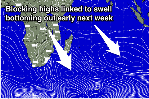
 This swell should ease through Friday, but a new S/SW swell will replace it through Saturday coming in at a similar size across both regions. From here on we'll see the surf dip away into Sunday and the start of next week, bottoming out through Tuesday afternoon and Wednesday.
Funkier winds from the north-western quadrant will persist into tomorrow before becoming more variable from Thursday and remaining so into the weekend.
Next week onwards (Nov 3 onwards)
As touched on above, the surf will bottom out through the first half of next week but generally variable winds should keep exposed spots open for business. We should see some better swell activity into the second half of the week and following weekend as good amplification of the Long Wave Trough moves through the Southern Indian Ocean, aiming some stronger polar fronts towards us, but we'll look at this in more detail on Thursday.
16 day Mentawai forecast graph
16 day Nias forecast graph
16 day South Sumatra forecast graph

