Active period of S/SE and then N/NE swell
Eastern Tasmanian Surf Forecast by Craig Brokensha (issued Friday March 15th)
Best Days: Tomorrow, Sunday, Monday morning, Tuesday, Wednesday morning
Features of the Forecast (tl;dr)
- Fading E/NE swell on the weekend
- Moderate + sized pulse of S/SE groundswell building later tomorrow, peaking early Sun, easing
- W/NW tending fresh N/NE winds tomorrow, W tending strong N/NE winds Sun
- Strengthening N winds Mon with a building NE windswell, peaking Tue with strong N winds, tending N/NW and then S/SE late
- Easing N/NE windswell Wed with a building S swell under strong S/SW tending S/SE winds
Recap
Fun, fairly consistent levels of E/NE trade-swell continued through yesterday and even today, offering 3ft sets on the magnets.
This weekend and next week (Mar 16 - 22)
The trade-swell will fade into the weekend, only to be replaced by our strong S/SE groundswell through tomorrow, peaking overnight/early Sunday morning.
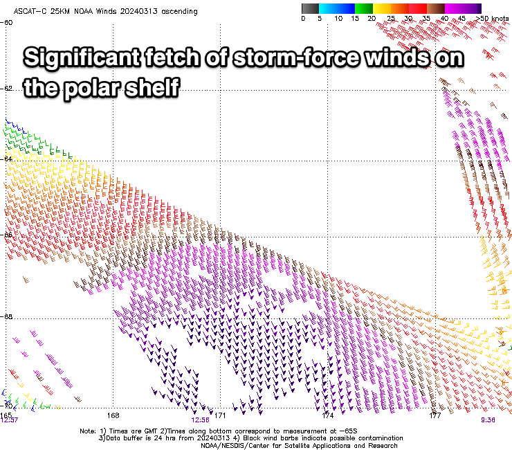
Looking at the satellite observations of the fetch generating the swell, and a broad swathe of storm-force S/SE winds were registered yesterday, with the swell due to build to 4-5ft by close of play tomorrow, peaking to 4-6ft Sunday morning, then easing.

Monday should still be 2ft to possibly 3ft but fading, with some building N/NE windswell to follow.
Coming back to the local winds and a W/NW offshore will freshen from the N/NE into the afternoon, with W'ly tending fresh N/NE winds Sunday.
Come Monday, moderate N'ly winds will strengthen during the day as an approaching low squeezes a high in the Tasman. Winds will remain strong from the N'th Tuesday, shifting N/NW later ahead of an evening S/SE change.
The strengthening N'ly winds should produce building surf to 2-3ft later Monday, peaking Tuesday to 4-5ft.
A slow drop should be seen Wednesday in the wake of the change Tuesday evening, with S/SW winds and fading 3-4ft sets, followed by some short-range S'ly swell. More on this Monday. Have a great weekend!

