Fun run of swell from the east
Eastern Tasmania Surf Forecast by Craig Brokensha (issued Monday 10th August)
Best Days: Tuesday, Wednesday morning, Thursday morning for the desperate, the weekend onwards
Recap
A small and bumpy southerly swell Saturday, cleaner Sunday with a new kick in size to 2-3ft which was a little unexpected.
Today our new NE swell filled in with good 3ft sets and light winds for most of the day.
This week and weekend (Aug 11 - 16)
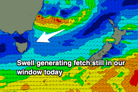
The strong and stalling low linked to today's NE swell is still generating a good fetch of strong E/SE winds just within our swell window, but will slip away to the north-east this evening.
With this we should see less consistent but fun sets continuing around 2-3ft tomorrow, easing from 2ft to possibly 3ft on Wednesday morning. There'll also be a small S'ly swell easing tomorrow from 2ft on the south magnets.
 Conditions should be clean with a W/NW tending N/NW breeze tomorrow, with W tending N/NE breezes on Wednesday.
Come Thursday small 1-2ft leftovers are due with a SW tending E/SE breeze.
From here the longer term outlook is a little tricky but a weakening mid-latitude low moving in from the west is expected to stall south-east of us, but then merge with a trough in the Tasman Sea. This could see a stationary fetch of strong E/NE winds aimed through our swell window producing some fun new E/NE swell from Sunday into next week.
We'll have to keep a closer eye on this in Wednesday and Friday's notes.

