New south swell pulses
Eastern Tasmania Surf Forecast by Craig Brokensha (issued Monday 6th July)
Best Days: Protected spots tomorrow, Wednesday south swell magnets, similar Thursday AM
Recap
Nothing to surf Saturday, while a fun new mix of Sly swells provided better options yesterday. This swell eased into today from a small 2ft on the south swell magnets.
This week and weekend (Jul 7 - 12)
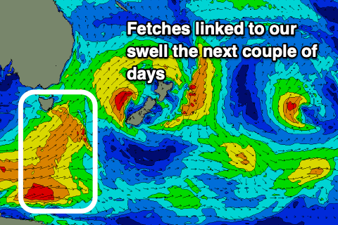
The weakest of the swells of the current episode have now passed and we look at the mix of long-period S'ly groundswell from a strong polar fetch of severe-gale W/SW winds, and short-range S'ly swell from a front spawning off it, pushing up past us this evening.
Both swells are due tomorrow, with the groundswell strongest into the afternoon.
 Size wise we should see 3ft+ waves across south facing beaches most of tomorrow, easing from 3ft on Wednesday morning, 2ft max on the sets Thursday.
Winds will slowly improve over the coming days with unfavourable SW tending S'ly winds tomorrow, W tending N'th on Wednesday (the best day) and NW tending N/NW Thursday.
Looking into the weekend there's nothing significant on the cards, but next week holds promise as a drifting upper cold pool moves in across the south-east of the country. This will meet an infeed of warm and moist easterly winds from the Coral Sea and a deep Tasman Low is likely the outcome.
The models still diverge regarding the location, strength and swell generating properties of this low, but it's one to watch and we'll provide more details in the coming updates.

