Get stuck in the coming days
Eastern Tasmania Surf Forecast by Craig Brokensha (issued Monday 12th August)
Best Days: Tuesday, Wednesday
Recap
A good kick in S/SE swell on Saturday to 4-5ft, but not the cleanest or best and more raw than anything. The swell was still solid but more to 3-5ft yesterday, not the cleanest again.
Today our new E/SE groundswell has peaked with great offshore winds as expected, coming in at a pumping 3-5ft.
Today’s Forecaster Notes are brought to you by Rip Curl
This week and weekend (Aug 13 - 18)
Make the most of the coming days as there's nothing too significance on the cards from Thursday.
Our E/SE groundswell seen today will drop back in size tomorrow, easing from a good and fun 3ft across open beaches, with a new S'ly groundswell due to build into the late afternoon.
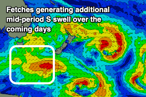
 A fetch of polar W/SW-SW gales generated just within our southern swell window over the weekend generated it, with sets due to reach 3ft into the late afternoon across south magnets, easing from a similar size on Wednesday. There'll also be a similar sized mid-period swell in the mix from a broad front currently south-east of us.
Winds tomorrow will go straight W ahead of NE sea breezes across some locations, NW others, favouring south magnets. Wednesday then looks great with a persistent offshore W/NW tending NW breeze.
Following this there's nothing significant on the cards until the weekend with a strong mid-latitude front moving in brings strong N'ly winds down the coast Saturday evening. The fetch isn't ideally aimed but we may see a 2ft wave across north swell magnets early Sunday with a N/NW tending W/SW change. We'll have a closer look Wednesday.

