Strong southerly swells inbound
Eastern Tasmania Surf Forecast by Craig Brokensha (issued Monday 29th July)
Best Days: Tuesday open beaches, Wednesday, Thursday and Friday mornings south magnets, late Saturday through early next week
Recap
Tiny amounts of background E'ly swell energy over the weekend, a bit better today with a small bump in S'ly swell.
Today’s Forecaster Notes are brought to you by Rip Curl
This week and weekend (Jul 30 – Aug 4)
We've got a very active forecast period from the south as a series of strong storms develop south and south-east of the state, into the end of the week owing to a strengthening node of the Long Wave Trough across New Zealand.
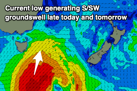
 Firstly though a strong low formed south of us last night and is generating a great fetch of gale to severe-gale S/SW winds in our southern swell window today.
The low has moved slowly east while still projecting severe-gale S/SW winds in our swell window this afternoon and evening, with a slight intensification of storm-force winds due this evening before continuing east.
A moderate sized S'ly groundswell should have been seen late today, with it peaking overnight but easing back from 4-5ft tomorrow morning at south magnets, while a good reinforcing pulse for Wednesday morning to 3-5ft is expected, easing slowly into the afternoon and down further from 2-3ft Thursday.
Winds will improve late tomorrow, SW most of the day and then W/NW near dark, while Wednesday looks great with W/NW tending NE winds. W/NW offshores are due Thursday morning, holding most of the day.
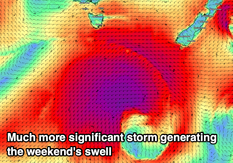
 A small pulse of new S'ly swell may be seen Friday to 2-3ft at south magnets, but of greater significance is a much stronger polar storm due to develop south-west of us on Friday.
A broad and encompassing fetch of severe-gale to storm-force SW winds are forecast to be generated in our southern swell window, moving slowly and projecting towards New Zealand over the weekend.
A large and powerful long-period S/SW groundswell is expected, building late Saturday and reaching 6ft by dark on the sets at south magnets, coming in larger and to 6-8ft on Sunday and then being very slow easing into early next week. Winds look offshore and out of the W/NW, but we'll have another look at this event on Wednesday and Friday.

