Flukey south swell early next week
Eastern Tasmania Surf Forecast by Craig Brokensha (issued Friday 18th January)
Best Days: South swell magnets through the day Monday
Recap
Tiny levels of background NE swell yesterday and today with clean conditions through the mornings.
Today’s Forecaster Notes are brought to you by Rip Curl
This weekend and next week (Jan 19 - 24)
The outlook for the coming period is still really average.
There's a flukey pulse of NE possible late tomorrow from a burst of strong N/NE winds off the southern NSW coast this evening, but in all reality we'll be lucky to see 1-1.5ft sets, and a morning W/SW wind will give into NE sea breezes, creating average conditions.
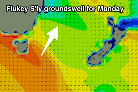
 We've got a flukey small S'ly groundswell possible for Monday now, with a zonal but strong low moving in from the west towards and then under the state due to generate a fetch of gale to severe-gale W'ly winds just in our southern swell window.
The swell is due to fill in Monday and peak through the middle of the day/early afternoon to 2ft to possibly 3ft at south magnets. Winds are looking great for south magnets as well with a morning W/NW offshore and NE sea breezes.
Mid-week a polar front pushing up and past us looks to bring a windy increase in S';ly windswell Wednesday with some possible better and cleaner small S'ly swell Thursday morning. More on this Monday though. Have a great weekend!

