Average period ahead, increasing Sunday but onshore
Eastern Tasmania Surf Forecast by Craig Brokensha (issued Wednesday 24th October)
Best Days: No great days, but most likely Monday morning at south magnets
Recap
Fading levels of small to tiny swell yesterday, tiny today.
Today’s Forecaster Notes are brought to you by Rip Curl
This week and weekend (Oct 25– 28)
With the background NE swell underperforming the last few days, I'm not expecting much in the way of size into the end of the week.
We may see a small short-lived spike in S'ly swell dawn tomorrow from a strong mid-latitude low passing under us this morning.
 If anything south magnets will see 1-2ft sets at dawn, easing through the day under a N/NW breeze.
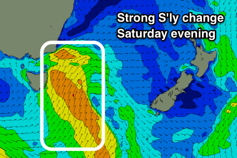
There's then nothing significant due until Sunday when a polar front pushing up across the state Saturday evening produces a burst of strong S'ly winds up past us.
A small S'ly windswell should be seen Sunday to 3ft across south facing beaches along with an average and fresh S/SW tending S/SE breeze.
Monday will be cleaner with a NW offshore but small and fading from 2ft.
Longer term we may see a fun N/NE windswell event developing later next week, but we'll have to review this on Friday.

