Northerly windswell developing late week
Eastern Tasmania Surf Forecast by Craig Brokensha (issued Monday 30th July)
Best Days: Friday afternoon
Recap
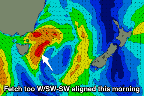
 Tiny surf over the weekend, with a new south swell due today, dependent on a mid-latitude low moving across us not showing.
This was due to the low taking a more zonal track with a fetch of SW winds generated in our swell window rather than S/SW.
Today’s Forecaster Notes are brought to you by Rip Curl
This week and weekend (Jul 31 – Aug 5)
Want to receive an email when these Forecaster Notes are updated? Then log in here and update your preferences.
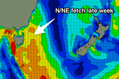
With today's S'ly swell not eventuating, we look towards the N/NE windswell event due at the end of the week, which is still on track.
From now until then, the coast is due to remain flat, but a vigorous mid-latitude frontal system moving in from the west across the country will squeeze a small though strong high in the Tasman Sea.
We'll see a broad and strengthening fetch of N/NE winds developing from the southern NSW coast down to us from later Thursday through Friday before a westerly change moves in during the afternoon.
 We're expected to see a building N/NE windswell through Friday, likely reaching a peak just as the NW change moves through, to 3ft+ across north-east facing beaches.
The swell will drop rapidly overnight and from a tiny 1-1.5ft Saturday morning with W'ly winds.
We may see another smaller N/NE windswell event developing over the weekend, but we'll review this and Friday's event again on Wednesday.

