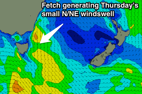
Small N/NE windswell for Thursday
Eastern Tasmania Surf Forecast by Craig Brokensha (issued Monday 16th October)
Best Days: Thursday at north magnets once winds swing offshore
Recap
No real signs of any significant S'ly swell over the weekend, with tiny lines yesterday and this morning.
This week and weekend (Oct 17 - 22)
As talked about on Friday, we've got building levels of N/NE windswell due across the coast through the middle of the week.
A slow moving high in the Tasman Sea is being squeezed by a coastal trough off the Qld coast, resulting in onshore stormy surf across the northern half of the East Coast, but none of this will feed down into us.
 An approaching mid-latitude low through the middle of the week though will see strengthen N/NE winds developing in our swell window Wednesday afternoon and evening, reaching a peak in intensity early Thursday morning.
The fetch will be angled away from us into Thursday and with this we'll see the swell drop from later in the day.
On Wednesday only a late increase in size is expected with very weak 2ft+ sets likely at north facing beaches along with a gusty N/NE breeze.
A peak in swell is due Thursday morning to 3ft across north-east facing beaches under NW tending W/NW winds, and a possible SW change on dark.
Come Friday no size is expected with clean fading 1-2ft sets max at north magnets.
Into the weekend there's no major surf due with the storm track being too zonal to generate any major size. Therefore try and make the most of Thursday when winds swing.

