Fun S/SE swell for Friday/Saturday
Eastern Tasmania Surf Forecast by Craig Brokensha (issued Monday 13th February)
Best Days: Friday afternoon, Saturday
Recap
Some small S'ly swell at magnets yesterday and this morning, fading through this afternoon.
This week and weekend (Feb 16 - 19)
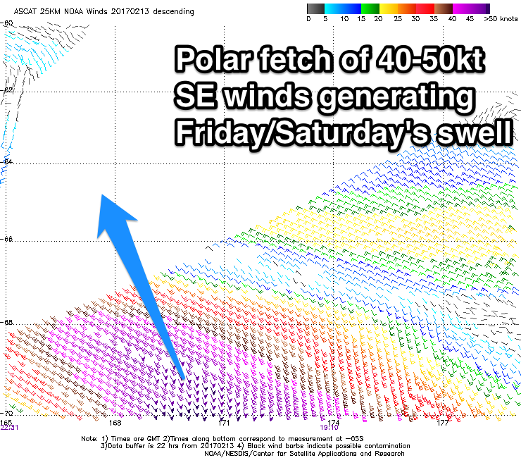
Tiny waves are due tomorrow and Friday morning, but into the afternoon and Saturday morning a new S/SE groundswell is due across the coast.
This has been generated by a satellite confirmed fetch of severe-gale to storm-force S/SE winds on the polar shelf.
 Although inconsistent, we should see open beaches to the south-east building to 2-3ft Friday afternoon/evening, easing from 2ft+ Saturday morning.
A small NE windswell is showing on the cards for Saturday as well, but this is being generated by a fetch of strong NE winds off the southern NSW coast and there'll be a bit of swell decay once it hits us.
North facing beaches may see 1-1.5ft sets, but I'd be focussing on the SE swell.
Winds Friday should be offshore from the W/NW-NW all day, with W/NW tending variable breezes on Saturday.
Looking into early next week, and besides a weak S'ly windswell generated by a fetch of strong S/SW winds right off our coast, the outlook is unclear,
The tropical activity looks subdued for now, but a low may form to our south-east, generating a small SE swell, along with a possible small NE swell mid-late week.

