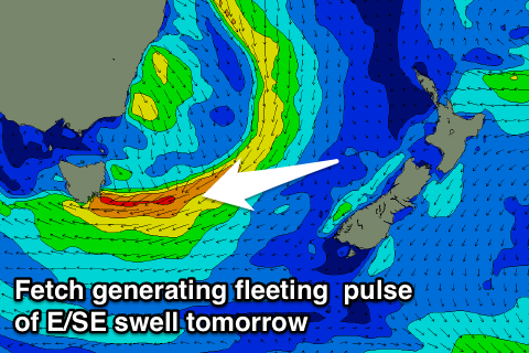
Rapidly easing E/SE swell tomorrow
Eastern Tasmania Surf Forecast by Craig Brokensha (issued Friday 30th September)
Best Days: Early Saturday
Recap
A large building NE swell yesterday with strong onshore winds, backing off just after dark.
This morning the swell was much smaller but cleaner with easing 3-4ft sets at exposed spots.
This weekend and next week (Oct 1 - 7)
 The broad low pressure system responsible for yesterday's NE swell is sitting just north-east of us with a fetch of E/SE winds sitting south-east of us this morning. This has dipped out of our swell window this afternoon and with this we'll see a small E/SE swell for tomorrow morning, fading rapidly during the day.
Open beaches should back off from 2ft to maybe 3ft early, tiny into the afternoon under NW tending W'ly winds.
Unfortunately from here there's nothing significant on the cards at all for next week as the westerly storm track fires up across the south of the country, being too zonal for us. Therefore make the most of early tomorrow. Have a great weekend!

