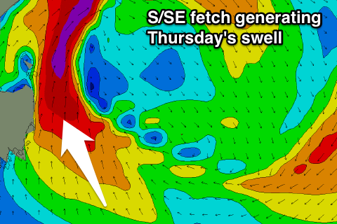
Good swell developing for Thursday
Eastern Tasmania Surf Forecast by Craig Brokensha (issued Friday 9th September)
Best Days: Thursday, Friday morning
Recap
Great surf over the weekend with a good NE swell with offshore winds Saturday morning, giving into a S'ly change through the morning, favouring spots picking up the most size. Sunday then saw the swell easing under W/NW offshores.
Today there wasn't much left at all.
This week (Sep 13 - 16)
As talked about last week, a developing inland low will dominate our surf outlook this week.
This low should start to form west of us tomorrow, with a weak fetch of E'ly winds being aimed into us tomorrow afternoon.
A weak increase in E'ly windswell is due to a poor 1-2ft by dark, holding a similar size into Wednesday.
The low should start drifting south-east while strengthening on Wednesday evening and Thursday, resulting in larger levels of S/SE swell developing as a fetch of SE-S/SE gales are generated right off our coast.
The low will be short-lived though, resulting in a quick spike and drop in size.
 Open beaches should kick late Wednesday to a stormy 3ft+ with onshore E/SE winds. Thursday will then see the swell from the S/SE to 4-5ft with S/SE tending S/SW winds.
A rapid drop in size is then due Friday from 2-3ft with offshore winds.
The models are still a touch divergent on the developments of this low, so check back Wednesday for an update on how much size we're expecting Thursday.
Beyond this there's nothing to major on the cards, so have a check back Wednesday for the latest update.

