Small flukey south swell Wednesday, better N/NE swell to end the week
Eastern Tasmania Surf Forecast by Craig Brokensha (issued Monday 5th September)
Best Days: Later Friday and Saturday morning
Recap
A building NE tending E/SE swell from a deep low off the coast Saturday, from 1-2ft in the morning, larger into the afternoon but with S'ly winds, favouring protected breaks.
The swell eased back steadily through Sunday, with today seeing tiny leftovers.
This week (Sep 6 - 9)
Tomorrow may see small traces of S'ly swell, while Wednesday morning is a better chance of this, generated by a strong but zonal mid-latitude low passing under us tomorrow afternoon.
A fetch of W/SW gales will be generated late in out swell window, producing a small spike in S'ly swell for Wednesday morning to hopefully 2ft at south magnets, fading through the day.
Conditions should be clean early but a freshening NE'ly will come up through the day.
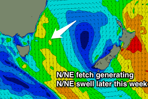
 This N/NE wind will be linked to an approaching front and we should see building levels of N/NE windswell through Thursday, peaking Friday just before the front moves offshore.
A kick to 2-3ft at north-east facing beaches is due later Thursday with strengthening N'ly winds, peaking Friday to 3ft+ with N/NW tending W/NW winds later in the day.
A rapid drop in size is then due Saturday from 2-3ft with offshores.
Longer term we may see some new S'ly swell early next week, but more on this Wednesday.

