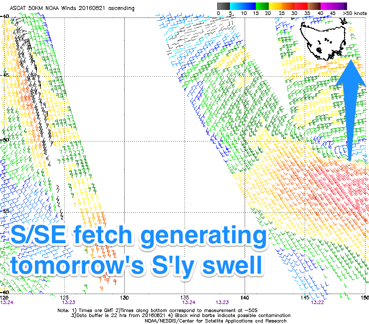
Fun S'ly swell for the coming days, good surf next week
Eastern Tasmania Surf Forecast by Craig Brokensha (issued Friday 19th August)
Best Days: Tuesday, Wednesday
Recap
Friday's NE windswell eased back from 1-2ft across north-east magnets but with less than ideal winds, tiny into Sunday. The surf kicked up a touch from the NE this morning but not to anything surfable.
This week (Aug 23 - 26)
 Our S'ly swell due across the coast tomorrow and Wednesday is still on track, with just a touch less size expected than on Friday. This is due to the fetch of S/SE winds being a touch further west and not quite as strong as forecast.
A good pulse of S'ly swell has been generated though, with it expected to build through tomorrow, reaching 3-4ft across south swell magnets through the day.
Conditions are looking good with offshore W-W/SW winds all day, while Sunday is expected to see W/SW tending SW breezes as the swell eases from the 3ft+ range Wednesday morning.
Not much is expected to be left Thursday with clean fading 1-2ft sets out of the S/SE.
One final small pulse of S/SE swell from the final weak stages of the low may be seen Friday afternoon, but not above 1-2ft at magnets.
Come the weekend there's nothing significant due across the coast, but we've got a good S'ly swell episode setting up for early next week.
A strong node of the Long Wave Trough will move slowly across the southern Tasman Sea, directing a series of strengthening polar fronts from south-west of the state, up towards the Tasman Sea.
This will be through our southern swell window, with a series of moderate S'ly groundswell pulses due from Monday through Wednesday next week. This looks to be with favourable W/NW winds as well, but we'll have another look at this Wednesday.

