Tiny to flat until Wednesday afternoon
Eastern Tasmania Forecast by Craig Brokensha (issued Friday 21st August)
Best Days: Wednesday afternoon, Thursday morning
Recap
A strong S'ly groundswell filled in yesterday with easy 4ft sets across exposed breaks with northerly winds favouring northern corners.
The swell eased back into today but was still providing good size across exposed breaks, with it due to ease further through the day.
This weekend and next week (Aug 22 - 28)
There's not much on the cards at all for the coming period now with a mix of easing S'ly groundswell and NE windswell tomorrow with NW winds.
Sunday is then looking tiny with a S'ly change kicking up a weak windswell for Monday morning only to 1-2ft max.
 Unfortunately the trough that's going to deepen off the Southern NSW coast will sit a little too far north and out of our swell window next week, resulting in tiny surf continuing.
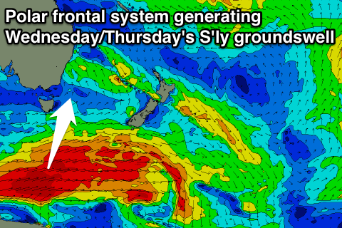
A strong new S'ly groundswell is due into Wednesday afternoon and Thursday though, generated by a broad and vigorous polar frontal progression pushing through our southern swell window early next week.
This groundswell will have to refract quite a bit but should build to a good 3-4ft later Friday and then ease from a similar size Thursday morning across south facing beaches. Winds will be sea breezey Wednesday afternoon and then NW to E'ly Thursday, with the morning being best.
Longer term we may see a secondary deepening surface trough drift down towards us from the north, bringing larger building levels of E/NE windswell and groundswell from Friday next week, but more on this Monday. Have a great weekend!

