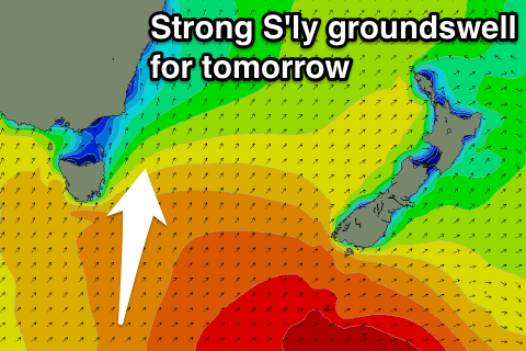
Pumping Thursday
Eastern Tasmania Forecast by Craig Brokensha (issued Wednesday 19th August)
Best Days: Thursday, Friday, Saturday morning, Tuesday onwards next week
Recap
Fresh pulse of S'ly swell yesterday with workable winds, easing back through today with morning offshores.
 This week and weekend (Aug 20 - 23)
Tomorrow's strong S'ly groundswell is still on track, with satellite observations picking up a fetch of 30-45kt SW winds being projected through our southern swell window. This swell should peak through the day to a solid 4-5ft across south facing beaches before easing later in the day and then down from 3-4ft Friday morning.
Conditions will be excellent for south facing beaches tomorrow with a NW tending N'ly breeze and then N/NW winds all day Friday mixed in with a small N/NE windswell.
Into the weekend a small mix of fading S/SE and NE swells are due from 2ft with NW breezes and then tiny leftovers Sunday.
Into next week, a surface trough moving across the region Sunday is due to stall off the NSW South Coast and strengthen, producing a fetch of SE gales just to our immediate north-east.
We should see small levels of E'ly swell spreading off this, producing building levels of E/SE swell through Tuesday and possibly persisting most of the week in the small range. We'll have a closer look at this Friday.

