Fun weekend of south swell, near flat most of next week
Eastern Tasmania Forecast by Craig Brokensha (issued Friday 7th August)
Best Days: Saturday, Sunday south swell magnets
Recap
A minimal pulse of S'ly swell was seen yesterday morning across the coast but a stronger increase was seen into the afternoon.
Today was the best day with more swell and offshore winds. A late pulse of better and stronger S'ly groundswell is due but winds have since gone onshore from the S/SE.
 This weekend and next week (Aug 8 - 14)
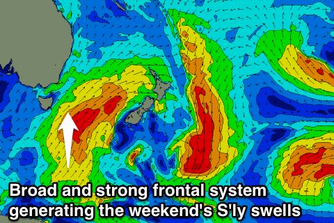
Satellite observations have confirmed a fetch of strong to gale-force S/SW winds through our southern swell window yesterday and this morning, producing a late pulse in S'ly groundswell today and secondary pulse for tomorrow morning.
South facing beaches should see strong and good 4-5ft sets tomorrow morning with 2-3ft waves at open beaches, easing a touch into the afternoon and then further from the S/SE Sunday, with 3ft sets early. Come Monday the swell will be small and fading from 1-2ft max.
Conditions are looking excellent over the weekend with a light W/NW tending light E/NE breeze and then freshening NW winds Sunday, N/NW Monday.
For the rest of next week there's nothing major due with fleeting pulses of N/NE windswell but not above 1-2ft max at north-east swell magnets.
Later in the week we may see a broad low pressure system form in the southern Tasman Sea, generating some new S'ly swell for Friday/Saturday but the models are divergent on this at the moment, so check back here on Monday for the latest on this. Have a great weekend!

