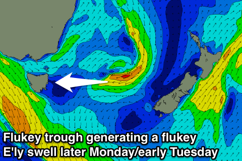
Flukey swell for late Monday/early Tuesday
Eastern Tasmania Forecast by Craig Brokensha (issued Friday 25th July)
Best Days: Possibly late Monday and early Tuesday for a flukey swell
Recap
The surf has slowly backed off the last day or so and this morning it was basically flat across the coast.
This weekend onwards (Jul 26 onwards)
A tiny NE windswell signature may be seen tomorrow morning but there doesn't look to be any major size attached to it, coming in at 1ft+ or so across exposed spots.
Sunday will remain tiny with an inconsistent SE groundswell not likely to top that 1ft+ range either.
 Into Monday afternoon and Tuesday morning a sneaky pulse of E'ly swell should be seen across the coast. Not much size is due with a small peaky 1-2ft wave likely, but this should be generated Sunday as the a weak trough moving towards New Zealand aims a short-lived fetch of strong to gale-force E'ly winds towards us.
It's only worth noting in the absence of anything else and strong W/NW winds will create clean conditions.
Besides this there's nothing significant on the cards at all with the westerly storm track firing up to our west, bringing zonal (west-east) activity across the state. This will keep the coast clean but flat and there's no change in the setup until possibly next weekend when we should see the fronts pushing up past our coast in a more favourable nature. We'll look at this on Monday. Have a great weekend!

