Minor Stratospheric Warming Event Recorded

TLDR:
- A minor warming event was recorded in the upper atmosphere during the middle of July
- These warming events result in cold air escaping the polar regions = more frontal systems across the mid-latitudes
- The Indian Ocean and Australian regions may see the increased frontal activity impacting through the middle to end of August
- This bodes well for an active end to winter
Unbeknownst to most, a minor sudden stratospheric warming event was observed through the middle of this month.
The term sudden stratospheric warming (SSW) might ring a bell for regular Swellnet readers, with a major event occurring in September 2019, leading to the horrific black summer fire season as strong frontal systems pushed up, across the country at a time when high pressure systems usually dominate.
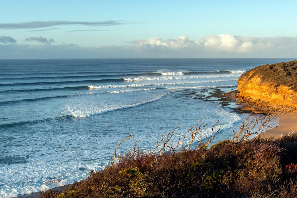
The Surf Coast could be a beneficiary of the SSW event (Scanlon)
So what is a SSW and how does it affect the Australian region, and more so our swell climate?
In short, it is as it reads: A sudden increase in the air temperature in the upper atmosphere, called the stratosphere.
The causes of such a warming in the Southern Hemisphere are still not fully understood, but this one looks to have occurred thanks to a strong wind disturbance over the Andes mountain range.
Much like an obstruction disturbing the regular flow of water down a river, high mountain ranges can do the same for the atmosphere. The obstruction sets off wobbles and eddies downstream.
Regular disturbances aren't powerful enough to break through from the troposphere (the lower atmosphere) to the stratosphere, but on rare occasions it can happen with the turbulence altering the layers of the atmosphere. Cold air will sink through the stratosphere, with the response to this being warm air lifted towards space.
This is a 'warming' event. And it will also cause downstream effects.
Typically, the stratosphere reaches a low point in temperature during winter, then gradually warms during spring. However, around the 14th of July, a rapid increase of 15°C was observed. This rates as a minor event compared to 2019 which saw a 75°C jump in temperature, but the timing of this warming is earlier than normal.

Sudden, 15°C warming registered in the statosphere (JMA)
So what does this all mean?
When there’s a warming in the stratosphere, we see a weakening of the polar vortex - the strong westerly winds that trap cold air to the poles - and if it’s a significant enough event, the westerly polar winds can even reverse and swing easterly.
We'll see no switch in winds this time, however the weakened polar vortex will allow cold air that would otherwise be trapped towards the pole by to 'escape' further northwards in latitude - i.e we can expect the westerly storm track to shift further north, known as a negative Southern Annular Mode (SAM) event.
The lag time between the warming event and the impact on the surface weather is usually a month or two, but current modelling has a strong negative SAM event travelling down from the upper atmosphere to the surface in the coming weeks to month.

Negative SAM event descending from the upper atmopshere (stratosphere) down to the surface (StratObserve)
What does this mean for the Australian region?
While a negative SAM event has the potential to bring stronger cold fronts up and into Australian waters, it’s not guaranteed. There will be increased activity, yet where in the Southern Hemisphere that activity occurs is hard to predict. For instance, it could happen across the South Pacific and mainly miss us.
Long-range modelling has the activity firstly impacting the Indian Ocean and Western Australia, possibly migrating further east during the middle to end of August.
Nothing is certain yet, and we'll keep watching the numbers closely, but the take-home message is that we could see some interesting developments in the Southern Ocean over the coming month. Watch this space.
Comments
Huge if tentative speculation is true.
Could be good for surfing , but not necessarily for the glaciers etc?
Assuming the timing of this should be a positive impact for increased snowfalls also.
Yay! Remember a month of May-like westerlies and swell in November if last one is anything to go by!
Remarkable to think that if I get in some good surfs in the coming weeks, I can put it down to a wind disturbance in the Andes. Love this analysis Craigos.
Also just quietly, whilst it’s still TBC, the surf coast is god damn due a weather event of some description going our way…
Understanding all these graphs, readings, temperatures etc of SAMs, MJOs and all the other atmospheric phenomenon Craig gives us really makes you realize why you needed to be very good at math to do meteorology. Craig does such a good job of explaining it all in layman's terms so we can understand. Always interesting.
Weatherman it is MATHS as in mathematics with and S unless you are a yank. There is no singular. This has crept into our English like rowt for route and that silly booey for buoy, and leash for leggie, it goes on and on. I know I am an anal pain in the arse but someone has got to keep us on the straight and narrow and keep the hordes at the border!
Hear Hear!!
I stand corrected, memlasurf. I completely agree with you. I am sure I wrote maths, but computer said no suggesting I spelt it incorrectly, which I should have ignored. I can assure you I will never eat a cookie, put my clothes in the closet, go to the drugstore, walk on the sidewalk, or put things in the trunk of my car. Hope you're getting some good waves. All the best.
Yes, otherwise memla will be running to the restroom to throw up.
Too true, thanks for the light treatment it can get gnarly on the net if you correct someone.
So should I take a punt and book that August snow trip...
Where ?
you will be able to ski up until grand final day if.... thats if lwt is aimed at victoria a few times.
So this should positively impact indo early to mid August?
'Swell Climate' TM ?
Finally, all the whinging might bear fruit
(You've schooled us well Craigos, I didn't need to google anything).
Thanks crew, it is very technical stuff, so if it's all making sense, that's great to hear.
Regarding snow, it depends where all the activity hits, if it's towards Western Australia we'll get warmer, wetter events for the alpine regions. Here's hoping it's all a bit more east, for both the surf and snow.
Some times a few points go over the top !
Rodger that cheers
Thanks Craig, clear and concise as always, hopefully it more towards WA :)
Incidentally, NZ is due its first proper snow event. Just in time for my 5 August Craigieburn trip.
No snow so far ?
Not much.
Bummer. I rode some of the community hills a while back ...2012 melted cheese
Was quite fun . The scariest part is getting to the damn hill. We camped at a hut out there was freezing ,super cold.....
It's worth noting that we're currently undergoing a second, stronger warming event, and this is what's shown by the second arrow in the forecast diagram below, far right.
It should send the SAM deeper into negative territory.
Here's NOAA's forecast (green lines)..
What are the chances of these warming spikes continuing?
Nice one craigos brilliant as always, could this impact the development of La Nina over summer?
I'm unsure to be honest, but I'd tend towards it not having much of an impact. I'll continue to look into it.
So potentially another burst of frontal activity in September Craig?
That Polar chill that escaped must have headed straight for Victoria...Bloody cold and miserable winter so far!!
Oh baby. Hopefully all the (potential) frontal activity is aimed right at SE Aus. Be awesome to see a snow season top the 3m mark. Think the last time that happened was back in about 1993.
https://www.cpc.ncep.noaa.gov/products/precip/CWlink/daily_ao_index/aao/...
Oh wow. Look for a LWT parked in the Bight...
what r our thoughts as of 8th august ladies and gentlemen....i hate to go the early crow but i feel like im counting on hope....there is a base if it does get cold and storm from the south we are still a chance.
The coming week is warm and we're on the down side of the action in the Indian Ocean. Look towards the second half of the month/early Sept for me. It's still too hard but the SAM has dipped significantly. It's all in the Indian Ocean though as expected for now.
Thanks for quick response.
Mr Frog's snowatch has the Vic resorts with sub 1m depths, and under 10cm forecast for next 15 days, not in favourable window yet. Good snow play conditions for the tobogganists?
At the moment looks Indian Ocean focussed.
Great little animation in this one.
The polar vortex bringing icy temperatures across southern Australia.
https://www.smh.com.au/environment/weather/the-polar-flex-bringing-icy-t...
Forecast for cloudbreak looks turd
Well, looks like SAM is just about to crawl back out of the deepest and prolonged negative it’s been in for years (I’m pretty sure), and we look to be on track to record possibly the warmest August on record. Oh the bitter irony.
Just confirms my previous observations regarding the SAM and not knowing where it will manifest. It's a Southern Hemisphere index and not Australia.
For example if the SAM peaks over the Indian Ocean it's brings west swell and warm weather for south-east Australia, but if further east we then start to see the better swell impacts and colder weather.
It looks to start moving east next week.
Fingers crossed! Though I’m sure the past few weeks of warm weather have well and truly kicked spring off for many of the plants and animals here in the SE. A return to more normal weather might come as a bit of shock.
The birds here certainly think Spring has sprung!
G'day Craig, in your article you made the following comment:
"Long-range modelling has the activity firstly impacting the Indian Ocean and Western Australia, possibly migrating further east during the middle to end of August."
Your original comment lines up perfectly with your comment directly above "It looks to start moving east next week.".
As per usual, you're on the money.
My question is, what's the long range now looking like for end of September / Early Oct for the Indian and Southern Ocean/s?