Forecast notes - new location!


Amen. Thanks.


Sweet. Now we just need a history/hindcast tab!


Looks great!! Good work boys


good stuff


Looks good!
I´m not sure how much work it would be, but it would be great to have a newsletter reminder if the new forecast notes go online. Just as an idea.
Cheers


Hey does this mean no more detailed logo recast??


Yeah good move thanks, one that I lobbied for a while back. However it's useless if you don't update it regularly. I'd rather have the old style longer range forecast notes if you're not going to be regular. B.t.w. Tas forecast notes are a week old now!
What happened to this?:
"The idea is that each region will have a blog-style forecast section, which will be updated a little more regularly than the standard Mon/Wed/Fri notes "
I missed that swell that popped up on Tuesday because I didn't see it confirmed on Monday's notes , by the time I realised, it was too late due to the wind coming on it during the day :(
Let me put my whining into context. We no longer have any surf webcams here in Tassie, this is a real bummer. We rely on; your Scamander and South Arm reporters each morning, your forecast notes and others and our own experience. While the 'on the ground' observers are pretty good and much appreciated, the vagaries of the Tassie coastline often require a lot more consideration and verification before we jump into the car for a couple of hours of driving. For example, it's not unusual to see a good size swell observed on the upper east coast but not hitting further down south on the lower east coast. Or having to wait until 8.30-9.00am to get a report from Scamander may mean missing a tide window when you take into account the long drive through to the coast from Hobart. One surf observation on the East coast isn't entirely adequate and the need for accurate, regular forecasting is even greater down here in my opinion.


Ha ha.. That's the proverbial story of our lives down here, thanks for the explanation anyway and all the best with your workload. I might start a topic, in one of the forums, regarding lack of cams and see if we can brainstorm any solutions. We used to have one at Eaglehawk Neck, but that seems to have gone down the gurgler with the demise of Coastview. Just having a cam back on that lower part of the east coast would make a big difference.


I take it that Craig takes his holidays over the same period each year?


Hi Ben,
Any chance of a forecast for Maldives central atolls July 12-23? How long for a low pressure system from south to make its way up there? 48 hours?
Cheers,
Scott


Still a long way out to have any real confidence on swell for those dates.
And I think this time of year you'll be surfing the east facing atolls hence you're really looking more for a big semi stationary high pressure system parked off of WA to generate some fun SE swell.
I can give you a forecast closer to the time. Say in about a weeks time.


Fantastic, thanks Don. Really appreciate your guidance.
Scott


Don , how about you do a monday forecast each week for the Maldives you seen to know your stuff for those waters....Dont think Ben would mind.


Sure Udo. But I don't work for free!!! ;)


Current super long range forecasts aren't showing anything of spectacular excitement come the start of your dates above, but as I said it's still a long way out so lets see what happens in another week or so.
I've only really looked at the SE swell......not 100% sure how much S/SW groundswell gets into the central atolls to be honest. Can you give me some guidance on the area/surf break you'll be surfing in the Central Atolls please so I can do some research.


Thanks Don,
Landing in Male and have flexibility to stay north or head as far down to meemu. We are on a boat so can be mobile.
Scott


Ok, things aren't looking too bad based on current forecasts. Looks like on your arrival day (12th July) you should have some 3-4ft+ SE swell with the upper end of this size range at the south swell magnets. Swell should slowly rise over the subsequent two days to peak around Friday 14th July in the 4-5ft range, again the upper end of this size range at the south swell magnets.
Swell then slowly wanes back down to a low point around late Monday 17th/Tuesday 18th, in the 2-3ft class, ramping up from this throughout Wed 19th (3-4ft by close of play), into Thursday (5-6ft by close of play) and levelling out around the 6ft/6ft+ class around Friday 21st and into Sat 22nd.
It's fair to say that this solid increase come the end of your trip has only just recently popped up on the models/charts and given it's still a LONG way out in terms of forecast time, I'd be taking this forecast for the end of your trip with some grains of salt. I'll update this for the end of your trip in a week or so's time.
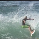

If you could stop running pics of the limestone coast, that'd be really cool :/


Its not THE limestone coast its a limestone coast. Just saying.


I know a few limestone coasts too . But theres pictures everywhere already of those coasts .
So where is this secretive limestone coast ?


old dog and clam........ Yes, semantics.... Fun for the whole family, old dog ;) .... But tell, me, if someone looks at the pic, then googles "limestone coast", where exactly are they pointed to?


*googled* The southeast . I see what you mean sheepdog . That name doesnt match the wave quality though does it ? The mud coast is appropriate


You are a legend. Thanks so much for the heads up. I'll do some more research regarding south facing possibilities. I really appreciate your generosity with this forecast Don.
Scott


@sheepy Why would any one bother going to THE limestone coast when all the real action is in the opposite direction. Bit of a hole if you ask me . Three weeks of onshore crap then two hours of offshores at night then back to crap . I spent a few winters in the 70's camped next to the Beachport locals in the desert and they said they got more waves in three weeks over there than the rest of the year back home. You can have it. Cheers.


Old dog, clam.
Yeah you're right.... Its shit here..... No waves here..
Cheers.


Haha ! enjoy it sheepdogg


I been following you lately. Been to Tas and SA for the first time this year.


Score any waves in Tassie, mitch?


@sheepdog, not so fast, come to think of it I've got some pretty good memories from down that way, even won the Robe contest in about '73, came second the year before in massive glass at ........... I wont even mention the classic bay the Beachport locals took us to in their 4 wheel drives. Stand up barrels anyone? Cheers dags.


Old dog.... Ahh good on ya man.... Robe and Beachport real estate has gotten a bit pricey now btw. And the rates at beachport are a fuckn joke... Put us off buying in the town... They have to dredge the harbour all the time, and the cost is thrown on all the home owners, even if you aint involved in the fishing / boating scene.
And you're wrong too.... The surf here is shit.... Best people don't come at all.... Waaaaaay better surf in vicco or over at Yorkes.....


Nothing to see hey sheepdogg ?


Really frustrating place to surf, the whole island that is. East Coast too small, South Arm too straight, Tasman Peninsula too inaccessible, West coast too burgerey whether big or small... Not like northern NSW anyway where you just keep driving south and look out the window to check it. And there's car parks at every beach, river mouth and headland. Having said that, I did get some nice small waves and good weather


West coast too burgery ?!


I reckon he's Bluffing !


Haha yeah wasn't really a surf trip so just had a look at a few of the obvious, easy access spots.


Mitch, yeah its intricate down there.... Lots of effort....
One of my most memorable scores was a left reef point set up on the north east coast, somewhere between Bicheno and St Helens. Quite a grunty paddle out. 2010 by memory. It was holding 6 foot with ease. Mellow crew..... Laughing at the qdler asking if the water was always this cold...... "You dont know cold".......... Yeah well i found out later bahahaha...
If I was to ever move back, That's the area I'd look at... It's a lot more consistent than the eaglehawk to Swansea part of the east coast... big ssw swells actually refract into there better... It cops cyclone swell believe it or not.... And big lows that form off nsw/ se vic pump it too.
Also scored a private little cove north of binnalong the following summer.. This amazing little grunty horseshoe.... Coloured stones.... Blue sky... Offshore all day.... Just the mrs on the beach collecting shells.... Beautiful memory.


Models have slightly pushed back the building of that SE swell for the last few days of your trip Scott. Now building from Fri 21st, peaking into Sunday 23rd at 5-6ft. But based on experience of the models start to push back long range swells that's never a really good sign. So let's see how it's panning out in a few days time.


Thanks Don,
Really appreciate the heads up. Hopefully head straight down to south Male as there seems lots of options in close proximity then down to meemu to hopefully get F1s. I've looked at magic seaweed as well and so I am guessing most of the trip will be around head high waves with the occasional chance of overhead on the odd day and at the south facing magnets. All of this will plenty fun for us old blokes.
Cheers and thanks again,
Scott


Hi Scott. I use the SN wave height scale in my forecasts. So 3ft is head high, 6ft is double overhead.
Also current wind forecasts are not looking good for the south swell magnets come Sunday 16th July and beyond. :(


Thanks Don,
We will make the best of what we get.
Cheers mate,
Scott


Hey don,
Love your forecasts for the maldives mate. Was just wondering if you had any idea what the outlook is for the north male atolls for late july/early august?
Cheers


Looking pretty fun. 3-4ft+ SE swell until the end of July and then a new pulse of S/SE groundswell beginning August with inconsistent sets in the 5-6ft class, with the upper end of this size at the south swell magnets until around Friday 4th Aug, slowly waning after that. Let me know your dates and I can do a proper forecast for you if you wish.
*Edit - We probably should move this to another/new thread. Ben et al, is this something you guys can do easily please?


Awesome thanks mate! Happy to move into a new thread if that suits but not entirely sure how to do that.
The dates we are heading over is 29th July - 6th of August!
Cheers


IF the below chart eventuates, and that a big IF, some certain mysto spots on the east and south east coasts of tassie could be off their faces.. I wont name names....... Do some research, and if the stars align, grab your 4/3 and scoot.....


Around 3-4ft+ for Sat/Sun 29th/30th, waning slightly come Monday 31st down into the 3ft/3ft+ range, with the upper end of these size ranges at the south swell magnets.
New S/SE swell pushing in on Tuesday 1st Aug building to 5-6ft+ by close of play and holding this level into Wed morning, slowly waning throughout Wed and maintaining 4-5ft+ throughout Thurs/Fri 3rd/4th. Again the upper end of this size range at the south swell magnets of the Nth Male atolls.
Saturday 5th sees this swell waning slowly, back down to 3-4ft+ by the end of the day, with slowly waning 3-4ft S/SE swell come Sunday 6th Aug, again the upper end of this size range at the south swell magnets of the Nth Male atolls.
Have fun!!!


sir donweather, care to gaze into the crystal ball once again for a cokes/ nth atolls prediction from the 20th onwards? Or are we too far out to know? you've been pretty spot on in the past
looks like a large Indian Ocean high is moving into position...but will there be swell?


We've finally made an addition to the surf report page so that you can easily access the Swellnet Forecast Notes via a tab (next the the WAMS).
The idea is that each region will have a blog-style forecast section, which will be updated a little more regularly than the standard Mon/Wed/Fri notes - basically whenever we see anything of interest (that is outside the scope of a regular forecast) it'll be discussed in this area.
We have migrated all of Monday's forecasts over to this section and from Wednesday onwards all future forecast notes will be uploaded in this way.