Large onshore surf to end the week
Western Australian Forecast by Craig Brokensha (issued Wednesday September 4th)
Best Days: Perth and Mandurah Saturday morning, all locations Sunday morning and Monday morning, Wednesday morning in the South West
Features of the Forecast (tl;dr)
- Large, mid-period W/SW swell for tomorrow and Fri AM, easing, smaller into Sat
- Strong W/SW tending SW winds tomorrow
- Strong but easing W/SW-SW winds Fri (possibly variable early Perth)
- E/NE-NE winds in Perth and Mandurah Sat AM with mod-fresh W/SW winds in the South West
- Large, mid-period SW swell Sun with variable morning winds in the South West, light E to the north
- Easing swell Mon with E/SE tending S/SW winds, freshening
- Smaller Tue with gusty S-S/SE tending S/SW winds
- Easing swell Wed with S/SE tending S/SW winds
Recap
Monday’s favourable condition gave way to freshening onshore winds from the get go yesterday with no real window of clean conditions across Perth and Mandurah.
Today we’ve got stronger onshore winds and larger, building surf.
This week and next (Sep 5 - 13)
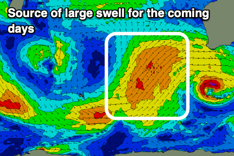
As touched on in Monday’s notes, a strong, high riding mid-latitude frontal progression is bringing with it strong onshore winds and large, developing surf across all regions.
The front will push through proper tomorrow, followed by a secondary front on Friday, with a further, third system clipping us Saturday.

Strong W/SW tending SW winds are due tomorrow along with surf to 12ft+ across the South West tomorrow and Friday morning with 4-5ft sets across Mandurah, 3-4ft in Perth.
The swell will start easing into Friday afternoon and strong but easing W/SW-SW winds will continue to create poor conditions. There’s an outside chance of variable winds around Perth but it looks low, so don’t count on it.
Saturday is a better chance with light E/NE-NE winds due across Perth and Mandurah as the swell continues to ease back in size. Sets to 2-3ft are expected across Perth, 3ft Mandurah while the South West will still be large and onshore with moderate to fresh W/SW winds.
Into Sunday, Margs will share in the cleaner conditions along with the arrival of a new, large mid-period SW swell. This will be generated by the third frontal system clipping us Friday evening, with the South West due to come in at 8ft+, 2-3ft Mandurah and 2ft Perth.

Variable tending light offshore winds are due in the South West, better E’ly to the north before sea breezes kick in. Monday looks smaller with better E/SE winds ahead of a trough and freshening SW-S/SW breeze.
A slow easing trend looks to continue through Tuesday and Wednesday, slowed slightly by a moderate + sized reinforcing SW swell. No major size is due and gusty S-S/SE tending S/SW winds will create poor conditions Tuesday, better Wednesday and more around to the S/SE.
Longer term we’re looking at a run of smaller swells with favourable morning winds, but more on this Friday.

