Make the most of tomorrow's swell
Western Australia Surf Forecast by Craig Brokensha (issued Monday January 16th)
Best Days: Tomorrow morning, the South West Wednesday morning and Thursday morning, the South West for the keen Saturday morning
Features of the Forecast (tl;dr)
- Moderate sized + mid-period SW swell tomorrow with fresh SE tending strong S/SE winds (S/SW Perth and Mandurah into the PM)
- Easing surf Wed, Thu and Fri with E/SE morning winds (strongest Wed AM) ahead of strong sea breezes
- Small mid-period SW swell for later Fri, easing Sat with E/SE tending strong S/SW-SW winds
- Inconsistent, mid-period SW swell building Mon, peaking Tue/Wed with E/SE-SE winds
Recap
Average winds with a building mid-period swell on Saturday, cleaner yesterday morning and easing back from the 3-4ft range in the South West. Mandurah and Perth were tiny and cleanest yesterday morning.
Today the swell is still small and a trough has brought poor winds, no good for surfing.
This week and weekend (Jan 17 - 22)
If you're looking for the most size, tomorrow will be the day for the coming period, with a new, mid-period SW swell due to peak through the morning as winds slowly improve as today's trough clears to the east and a high moves in.

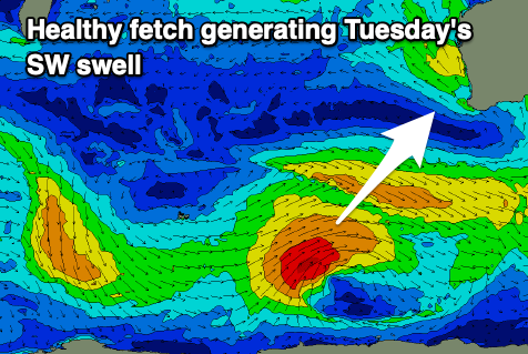
The swell was generated by a broad but not overly strong polar low that formed around the Heard Island region late last week. A fetch of sub-gale-force W/SW-SW winds were generated in our south-western and then southern swell windows, producing a good 6ft+ of swell for the South West tomorrow morning, with Mandurah building to 2ft+ and with 2ft sets across Perth.
Winds will ease and tend fresh SE tomorrow morning, with strong S/SE breezes into the afternoon (S/SW-SW) to the north in Mandurah and Perth.
Wednesday looks cleaner but with easing surf under a gusty E/SE offshore before sea breezes kick in. Easing 4-5ft sets are due in the South West with 1-1.5ft sets fading across Perth and Mandurah.
The surf will continue to ease and drop away into Thursday and Friday with favourable offshore winds out of the E/SE ahead of afternoon sea breezes.
Later Friday but more so Saturday morning a small pulse of background mid-period energy is due, but this will just prevent the South West from going flat with small, slow 3ft sets due.

Morning E/SE winds look to create clean conditions again before sea breezes kick in again.
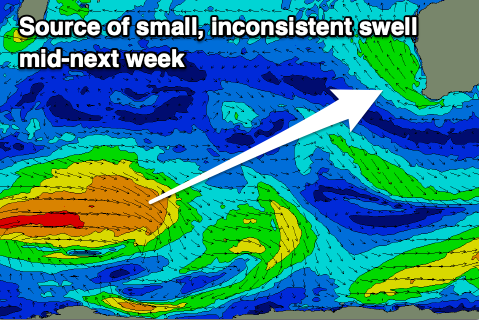
Longer term, some small, inconsistent mid-period energy is due from a weak, slow moving frontal progression that will develop to the south of South Africa tomorrow evening.
Inconsistent sets are due to start building Monday before peaking Tuesday/Wednesday to the 4ft range in the South West, tiny to flat to the north.
Winds are a little unsure for Tuesday/Wednesday as an inland trough deepns to check back for more on this Wednesday.

