Persistent onshore winds across the South West
Western Australia Surf Forecast by Craig Brokensha (issued Friday 19th May)
Best Days: Perth Saturday morning, Monday morning and Tuesday morning
Recap
OK waves in protected spots picking up the leftover swell yesterday in Margs, with tiny bumpy waves to the north.
Today fresher onshore winds were developing across most locations with a slow increase in new swell.
This weekend and week (May 20 – 26)
The weekend is still looking onshore and messy, but the strength of tomorrow's W/SW swell has been upgraded in response with the mid-latitude front moving in from the west being stronger.
We'll see a fetch of pre-frontal W/NW gales followed by slightly weaker post-frontal W/SW winds move in and across us this evening, generating a moderate to large sized mid-period W/SW swell tomorrow.
Margs should see 6-8ft waves with 2-3ft sets in Perth.
Winds are now looking better for Perth as we fall in between fronts Saturday morning, resulting in light variable and likely light offshore E'ly winds (W'ly around Margs), increasing from the W/NW and then NW through the afternoon. In saying this conditions will still likely be quite lumpy and mixed from overnight onshores.
This freshening NW'ly will be linked to our secondary mid-latitude front moving in from the west, pushing through early Sunday morning kicking the swell back up to 8ft into the afternoon in the South West and 3ft in Perth again.
Strong SW winds will create poor conditions though, lingering into Monday and remaining fresh as the swell slowly eases. There's a chance for more variable breezes in Perth as the swell drops from 2ft with the odd bigger one.
 Into Monday afternoon a new S/SW groundswell is expected across the South West, produced by a stalling low in our southern swell window, south of the mid-latitude front moving through Sunday.
This low will project a fetch of gale to severe-gale S/SW winds through our southern swell window, with the S/SW groundswell expected to build to 6-8ft later in the day, easing back from the 5-6ft range Tuesday.
Onshore winds will continue in the South West Tuesday (light offshore around Perth).
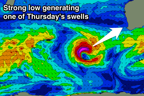
Into later Wednesday and more so Thursday, a mix of long-range inconsistent SW groundswell from a strong polar low forming south of South Africa and closer-range SW groundswell from an intense low is expected.
The closer-range swell will provide the most consistent size, but we'll probably see some weird double ups at times when the two swells combine. A peak in size is due Thursday morning to 8ft+ range in the South West and 2ft to occasionally 3ft in Perth but onshore winds look to spoil the party. We'll have another look at this Monday though, have a great weekend!

