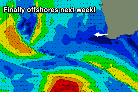
Average weekend, much better next week
Western Australia Surf Forecast by Craig Brokensha (issued Friday 19th August)
Best Days: Perth early Saturday and Sunday for keen surfers, both regions Tuesday morning (protected spots South West), Wednesday and Thursday
Recap
Easing storm swell yesterday morning with improving conditions across Mandurah and Perth as winds tended offshore just before or shortly after dawn. Perth and Mandurah were a raw 3-4ft or so, with poor conditions in the South West and onshore 6-8ft surf.
Today Perth and Mandurah were much cleaner and better with offshores and 3ft sets, while the South West continued to get battered.
This weekend and next week (Aug 20 - 26)
Tomorrow isn't looking too flash with a small mid-period W/SW swell due to fill in along with onshore W/SW tending SW winds. Perth and Mandurah are likely to see early variable winds with small 2ft sets before the onshore kicks in.
Come Sunday a higher chance of early E/NE offshores is due across Perth, while Margs will see increasing W/NW winds from dawn ahead of a late S/SW change. Perth is only due to be around 1-1.5ft.
 Our large W/SW groundswell for early next week is still on track, with a strong polar frontal progression firing up south of South Africa, traversing slowly across the southern Indian Ocean, while generating W/SW gales.
The frontal progression will weaken while approaching us into Sunday, but still directing strong SW tending S/SW winds into the coast (Sunday's afternoon change).
Size wise the swell should build through Monday and reach 8ft later in the day across the South West, 2ft+ in Perth, peaking Tuesday morning to 8-10ft and 2-3ft respectively.
Conditions will be poor as the swell builds with S/SW breezes, but Tuesday should see S/SE winds across the South West, and SE breezes further north.
Wednesday will be cleaner again as the swell continues to ease under E/NE tending SE winds.
Longer term a good reinforcing SW groundswell is due Thursday morning from a strong pre/post-frontal combo fetch of gale to severe-gales, coming in around 5-6ft across the South West and 1-2ft in Perth under E/NE offshores. Beyond this some larger swell is due mid the following week, but we'll have another look at this Monday. Have a great weekend!

