Average weekend, pumping Tuesday and Wednesday
Western Australia Surf Forecast by Craig Brokensha (issued Friday 26th September)
Best Days: Monday morning up at Gero, later in the day around Margs, Tuesday and Wednesday everywhere
Recap
A large pulse of SW groundswell was met with average onshores in the South West yesterday but Perth was on the pump again with morning offshores before weak NW sea breezes kicked in. Gero was also fun and clean through the morning.
A drop in swell was seen through this morning with less favourable winds across all locations besides Gero which saw morning offshore NE winds.
This weekend (Sep 27 - 28)
Two large and powerful W/SW groundswells over the weekend will be spoilt by onshore winds across all regions over the weekend, as a strong frontal system associated with the swells pushes across us.
Strong W/SW winds (W/NW early in Perth and NW up at Gero) are due through tomorrow as an initial increase is seen with weaker fresh W'ly winds through Sunday leaving no real options for a decent wave. Gero will see lighter SW winds Sunday but still bumpy conditions.
Next Monday onwards (Sep 29 onwards)
 Sunday afternoon's large kick in W/SW groundswell should start to ease into Monday ahead of a reinforcing large SW groundswell Tuesday afternoon from a polar front firing up from our south-west towards the Bight.
Winds will improve for protected locations in the South West with a moderate W/SW tending S/SW breeze, opening up fun waves later in the day. Perth will remain average but Gero should see variable winds with an easing 5-6ft+ of swell.
Tuesday is the day to surf across all coasts with the mix of swells to 6-8ft in the South West, 3ft in Perth and 4-5ft up at Gero as winds swing offshore from the E/SE (SE up at Gero).
Wednesday will be even cleaner across more exposed breaks with a fresh offshore E'ly breeze across all locations (even tending E/NE from Perth North) as the SW swell backs off.
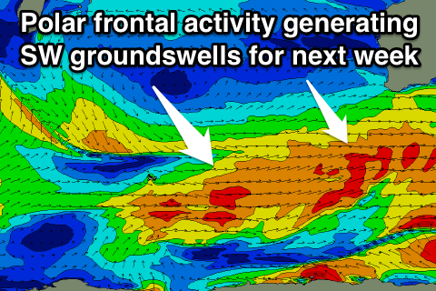
Through the rest of the week, moderate levels of SW groundswell are due to persist from polar frontal activity skirting around the bottom of a blocking high to our west, with a fresh long-range pulse due Thursday to 5-6ft in the South West, 2ft+ in Perth and 3-4ft+ up at Gero but winds look to swing onshore as a trough moves in from the west with fresh SW winds across most spots. These should ease into Friday and possibly tend variable across select locations.
Longer term we may see some larger close-range W/SW swell for next weekend with onshore winds, but more on this Monday. Have a great weekend!

