Make the most of today

Victorian forecast by Craig Brokensha (issued Monday January 27th)
Best Days: Today, Sunday morning
Features of the Forecast (tl;dr)
- Easing swell tomorrow with gusty SW-S/SW winds (possibly lightet W/SW at times in the AM to the west)
- New, moderate sized mid-period SW-S/SW swell Wed with strengthening S winds
- Easing swell Thu and Fri with mod-fresh S/SW winds Thu, moderate S/SW Fri
- Small-mod sized mix of SW groundswell and mid-period W/SW swell building Sat, peaking in the PM with S/SE winds
- Easing swell Sun with N/NE tending S winds
- Smaller Mon with S/SW winds
Recap
The Surf Coast finally awoke from its slumber with an initial pulse of mid-period SW swell filling in nicely Saturday and reaching 3-4ft by mid-morning, stronger into the afternoon but with choppy conditions thanks to a strong onshore wind.
The swell backed off a touch yesterday morning before building back into the afternoon but conditions were still a mess with gusty onshore winds.
Today we’ve seen winds swing back offshore for most locations, with improving conditions on the Surf Coast as morning N/NE winds shift more N/NW-NW into the afternoon ahead of SW change by about 5pm. Winds should hold out of the N/NE for most of this time to the east, so make the most of it.
The weekend’s swell is on the steady ease but a fun 3ft to occasionally 4ft on the Surf Coast with a bit of easterly peak, 4-6ft to the east.

Great surf Saturday morning with the building swell

Offshore winds with chunky closeouts this morning
This week and weekend (Jan 28 - Feb 2)
Make the most of today’s surf ahead of the change, as we’ve got a poor week of winds to follow.
Firstly, this evening’s change will leave gusty SW winds into tomorrow morning along with a further drop in swell from the weekend. There’s a chance for a period of lighter W/SW winds in pockets across the Surf Coast during the morning but it’ll be small and average.
Into Wednesday a mix of mid-period S/SW swells are due thanks to strengthening storms developing just south-west of us this evening and through tomorrow.
Unconsolidated fetches of strong to gale-force winds should kick up 4ft or so of swell for the Surf Coast Wednesday with 6ft waves to the east but with poor, strengthening S’ly winds leaving nowhere to hide.
The swell will start to ease into Thursday from 3ft to possibly 4ft on the Surf Coast, 5ft to the east as winds relax a little but persist out of the S/SW, moderate to fresh in strength.
Winds will ease a little more in Friday but persist out of the S/SW with S/SE winds on Saturday as a mix of new swells start to build (discussed below).
It won’t be until Sunday that we finally see winds swing back offshore from the N/NE and this will be along with the easing mix of swells from Saturday.
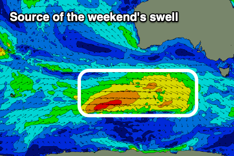
The first source of swell for Saturday will be an initial strong but distant polar low that's currently around the Heard Island region, generating an inconsistent groundswell for the morning.
A more consistent, stronger pulse of W/SW swell into the afternoon will be generated by a flurry of pre-frontal W/NW winds followed by slightly stronger post-frontal W’ly winds, developing south-west of Western Australia Wednesday before pushing under the country Thursday.
This second pulse looks small to moderate in size as this stage with it due to build Saturday afternoon, peaking overnight and then easing Sunday.
The Surf Coast should reach the 3ft range through Saturday afternoon, easing from 3ft Sunday with locations to the east hitting 4-6ft before easing back from 4-5ft or so Sunday morning.
A trough will unfortunately bring a S’ly change Monday as a new pulse of W/SW groundswell fills in. This swell and possible following energy looks to be generated by a couple of decent looking storms firing up under the country on the weekend and early next week. Local winds are too hard to nail down but check back here on Wednesday/Friday for the latest.