Onshore winds set in with no significant swells
Victoria Forecast by Craig Brokensha (issued Monday 17th December)
Best Days: Keen surfers both coasts tomorrow, exposed beaches Wednesday mid-morning to early afternoon
Recap
An average start to the day Saturday with onshore winds and an easing SE windswell back from 3ft+ across most locations, but winds tended variable and went light offshore through the day, creating super fun waves on the beaches for those who waited it out.
Sunday was smaller but nice and clean on the exposed beaches as a new inconsistent groundswell filled in. This groundswell has peaked today to an inconsistent 3ft on the Surf Coast, cleanest on the reefs, with bumpy average waves to the east. An onshore change has since moved through creating bumpy conditions.
Today’s Forecaster Notes are brought to you by Rip Curl
This week and weekend (Nov 18 - 23)
Our current inconsistent swell is due to ease back through tomorrow and winds will remain onshore creating bumpy conditions. There won't be too much strength to the S/SW breeze, but enough to add a few bumps with easing 2-3ft waves on the Surf Coast and surf around 4ft on the Mornington Peninsula.
Winds will swing to the E-E/NE on Wednesday morning creating poor conditions on the Surf Coast with a small mix of swells to 1-2ft, with the Mornington Peninsula clean but also small and to 2ft to sometimes 3ft.
 A surface trough/weak low drifting in from the north-west is expected to bring stronger onshore winds from the SE tending S'th and no new groundswell.
This will kick up a weak windswell across both coasts Friday, but not likely above 2-3ft, with easing levels of windswell and a small very inconsistent background groundswell with onshore S/SW winds.
Unfortunately there's nothing significant due into the weekend with persistent onshore S/SW winds on Saturday, possibly variable Sunday morning but with no size at all.
The run of onshore winds and lack of swell will be linked to the surface trough/weak low lingering off the East Coast through the end of the week and weekend as a strong stationary high sits to our west, blocking our swell window.
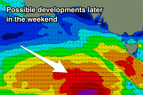
We may see a strong polar frontal progression develop later in the weekend generating a much better SW groundswell for Christmas Day, but more on this Wednesday.

