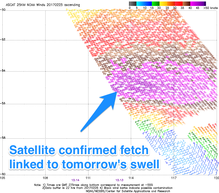
Fun swell tomorrow with favourable winds
Victoria Forecast by Craig Brokensha (issued Monday 27th February)
Best Days: Both coasts mid-morning tomorrow onwards, Wednesday morning east of Melbourne
Recap
Besides a few selected spots out of the wind and open to the swell Saturday, conditions were poor with gusty S'ly winds and a good building W/SW groundswell.
The surf eased back through Sunday as lighter E'ly winds developed through the morning east of Melbourne, favouring selected spots.
This morning was the pick with a lighter E/NE offshore on the Mornington Peninsula and clean 3-4ft sets, while the Surf Coast was small and bumpy.
This week and weekend (Feb 28 – Mar 5)
A low point in swell is still expected early tomorrow but our new SW groundswell from a intense polar low should arrive mid-morning.
 Satellite observations picked up a good fetch of gale to severe-gale W'ly winds through our south-west swell window, but the east-southeast track of the low wasn't ideal.
Still we should see good but inconsistent 3ft sets developing on the Surf Coast by midday/early afternoon with 4-5ft sets on the Mornington Peninsula.
Conditions will be favourable for both coasts through the morning with a light N'ly offshore, tending variable midday/early afternoon before sea breezes kick in.
The swell should ease back through Wednesday but winds will have a little more east in them, light from the NE through the morning, favouring locations east of Melbourne. The Surf Coast is only due to be around 2ft, with easing 3-4ft sets on the Mornington Peninsula.
Thursday isn't looking too flash with smaller surf and a variable wind from the E/SE, freshening through the day out of the S/SE.
Winds will strengthen out of the E/SE through Friday and Saturday owing to a small surface trough deepening and stalling off the southern NSW coast.
A small junky SE windswell will develop across the Surf Coast, peaking Saturday but with poor E/SE winds. The low will then dip south Sunday swinging winds S'ly, continuing to create poor conditions.
There'll be a small to moderate sized S/SW groundswell in the mix on Saturday, from a strengthening polar low late in our swell window Wednesday. This should see 2-3ft waves on the Surf Coast and 3-5ft waves on the Mornington Peninsula, spoilt by the gusty E/SE breeze.
Longer term we may see the low re-develop off the southern NSW coast, continuing to direct poor winds across the state, but more on this Wednesday.

