Good swell tomorrow, average weekend with weak swell, better next week
Victoria Forecast by Craig Brokensha (issued Wednesday 20th July)
Best Days: Both coasts Thursday, Surf Coast Friday, Surf Coast Sunday, Surf Coast from Tuesday next week
Recap
A pretty slow day of waves yesterday with an inconsistent long-range W/SW groundswell around 2ft on the Surf Coast and 3-5ft on the Mornington Peninsula.
There wasn't much of an increase seen later in the day, but this morning a peak in new W/SW groundswell is offering good 3-4ft sets on the Surf Coast and 5-6ft on the Mornington Peninsula under variable tending locally offshore winds.
This week and weekend (Jul 21 - 24)
This morning's pulse of SW groundswell should ease back a touch through today as winds remain relatively light and variable.
Our secondary pulse of slightly stronger groundswell due tomorrow morning is still on track, and it's probably more SW in direction than W/SW.
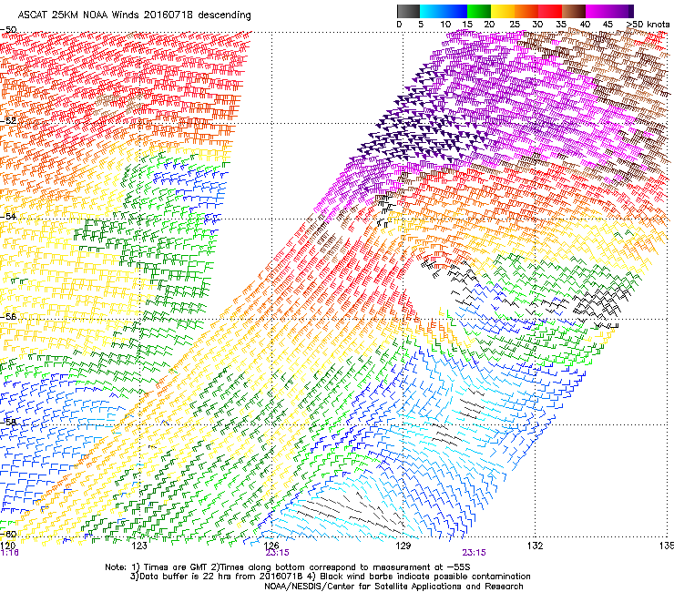
 This swell was generated by a stronger mid-latitude front firing up on the back of the system linked to today's swell, but stronger storm-force winds were recorded at the core of this second system (right).
We should see the Surf Coast offering larger 3-5ft waves tomorrow morning with 6-8ft sets on the Mornington Peninsula.
Conditions will vary through the day across the Surf Coast, improving for the reefs into the afternoon as the swell starts easing with a morning N/NE tending N/NW breeze. Locations to the east should remain clean most of the day though with a N/NE tending N'ly breeze.
The surf will continue to ease into Friday morning from 3ft on the Surf Coast and 5ft range on the Mornington Peninsula along with fresh and gusty NW tending variable W'ly winds with a passing front.
Now, the model divergence regarding the strength of a two pronged frontal system moving through Friday and then Saturday has been ironed out, and as forecast on Monday, we're not likely to see much swell at all from the first burst (even though the last few days models upgraded this fetch to 50kts - much weaker now), and the secondary burst through Saturday is the one.
Coming back to the first burst, and we're hardly due to see any swell at all from this, with a shortened fetch of strong to gale-force W'ly winds pushing through Friday morning, not likely to generate any additional size above the easing SW groundswell into the afternoon.
Into Saturday though, a better fetch of W/SW gales will projected in and through Bass Strait, with a greater fetch length extending out behind it.
A moderate sized increase in W/SW swell is due off this front, with weak windswell through the morning, growing to short-range mid-period energy by the afternoon and then easing Sunday.
The Surf Coast should build to 3-4ft through the mid-late afternoon with 6ft+ sets on the Mornington Peninsula, easing back from 3ft+ and 5-6ft respectively Sunday morning.
Winds on Saturday are really tricky with the front moving through and we're likely to see an early strong W/SW'ly easing and swinging more W'ly possibly later in the day, but we'll review this Friday. Sunday is the pick with N/NW-NW offshores.
Next week onwards (Jul 25 onwards)
 Monday morning isn't expected to see much size with a possible acute W'ly swell due into the afternoon from a high riding mid-latitude front. Fresh W/NW winds will limit surfing options to the Surf Coast but I wouldn't expect much over 2ft.
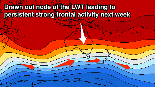
Of greater significance is the progression of what looks to be at least 3 very strong and broad back to back polar fronts through our swell window from this weekend through mid-next week.
With this we're set to see back to back to back moderate to large long-period SW groundswells from Tuesday next week under the influence of a drawn out node of the Long Wave Trough. We'll have a closer look at this Friday.


Comments
Trying to understand synoptics. Its looking like NW after lunch?
Oh yeah!!
How's these lines at 13th Beach!