Biggest surf Tuesday; small to finish the week; minor pulse Saturday
Sydney, Hunter and Illawarra Surf Forecast by Ben Matson (issued Monday 20th November)
Best Days: Tues: fun E/NE swell with mainly light winds. Wed/Thurs: smaller surf with light winds. Sat: small rebuilding E/NE swell with mainly light winds.
Recap: Short range NE swell produced 2-3ft surf on Saturday, easing into Sunday. Winds were onshore so conditions weren’t great. Today we’ve seen the NE swell ease right back but a new long range E/NE swell build with sets now around the 3ft mark. Slightly bigger waves are expected later today ahead of a peak overnight or early Tuesday morning. Winds were briefly onshore this morning but swung light and variable mid-morning where it’s remained for the rest of the day.
Today’s Forecaster Notes are brought to you by Rip Curl.. which is convenient timing for a shameless plug, given the recent upwelling event that plunged local sea temps. Early Xmas present/new steamer perhaps? Clicky clicky for more.

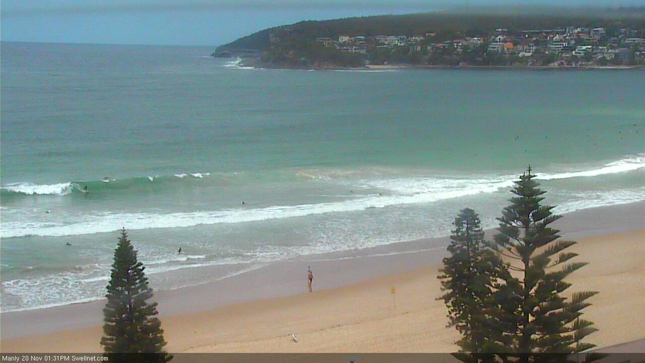
Manly early afternoon, fun clean beachies
This week (Nov 21st - 24th)
No changes to the outlook for the next few days.
Our incoming E/NE swell will reach a peak in size overnight or early Tuesday and then slowly trend down into the afternoon and through Wednesday.
Set waves should manage 3-4ft at open beaches on Tuesday morning, though south facing beaches will be much smaller (and also the northern Hunter, due to the swell direction).
As for conditions, a large blocking high will remain in position through the Tasman Sea for much of the week, keeping wind strengths light. We may see brief periods of onshore winds at times (like this morning) but they’ll be short lived. However without a synoptic offshore conditions won’t quite be perfect.
Although our E/NE swell will ease steadily through Wednesday, we are unlikely to see flat conditions to finish the week.
There are couple of regions of activity that are worth keeping an eye on - one is a small S’ly fetch adjacent New Zealand’s South Island, which feeds into a second source - a moderate ridge through the northern Tasman Sea. They’re both poorly aligned for our coast but should maintain small peaky 1-2ft+ waves through Thursday, becoming a little smaller into Friday.
Winds will freshen from the N/NE later Thursday and Friday as the Tasman high moves a little further to the east, though no great strength is expected.
This weekend (Nov 25th - 26th)
We’ve got some small mid-range E/NE swell inbound for the weekend.
A building ridge through the north-eastern Tasman Sea from Wednesday night onwards is expected to retrograde westwards towards the East Coast into Thursday, and although not terribly strong, will produce some fun surf for Saturday around the 2ft, maybe 2-3ft mark. It’ll be quite tidally susceptible though.
The ridge will remain stationary into Friday but then shift its axis more to the north, marginally shutting off the swell supply to Southern NSW. This will lead to a small reduction in size into Sunday, though most open beaches should still see occasional 2ft sets.
Conditions look fun at this stage with mainly light variable winds, possibly freshening NE into Sunday afternoon.
It’s worth nothing that an E’ly dip at the head of the fetch has been going through a significant upgrade/downgrade cycle over the last few days in what’s quite a dynamic atmospheric environment, so we’ll need to keep a watch on this as well. Any likely upgrades will probably favour Northern NSW and SE Qld but there would be some benefits to us if it occured.
I’ll also be keeping an eye on a small trough developing SE of Tasmania around Friday. It doesn’t look like much right now (likely to favour Tasmania more so than anywhere else) but could be the source of a small S/SE swell later Sunday and into Monday morning.
Next week (Nov 27th onwards)
Our southern swell window has been a little inactive of late, and the long term guidance suggests more of the same, apart from the aforementioned S/SE swell that may crop up later Sunday (for Monday). It's way too early to discuss size and/or conditions though.
Elsewhere, we’re looking at a semi-stationary ridge through the Northern Tasman Sea that’ll supply a lengthy period of small trade swell for Southern NSW through next week, but may also become the catalyst for further troughy systems that could spin up into decent swell producers. More on this in Wednesday’s update.

