Continuation of tricky winds and small swells
Sydney, Hunter and Illawarra Surf Forecast by Ben Matson (issued Wednesday 4th January)
Sign up to Swellnet’s newsletter and receive the Sydney, Hunter and Illawarra Forecaster Notes and latest news sent directly to your inbox. Upon signup you'll also enter the draw to win a surf trip to P-Pass for you and a mate. It doesn’t get much easier so click HERE to sign up now.
Best Days: No amazing days but there'll be small peaky beachies most days worth a quick early paddle.
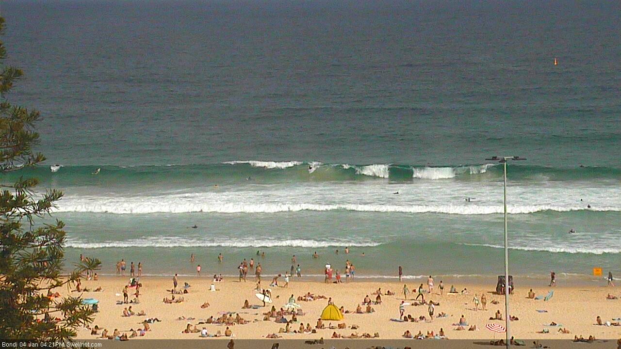
Recap: Punchy short range 3-4ft S’ly swell on Tuesday morning was replaced by a better, longer period 2-3ft SE swell late afternoon that has persisted throughout today. Unfortunately, winds have remained onshore for all of Tuesday and throughout Wednesday morning, so conditions have been a little worse for wear, though they eased after lunch today allowing for reasonable conditions this afternoon. A small new E’ly swell is also filling into the coast.

Improving conditions at Bondi this afternoon with a small fun SE swell
This week (Jan 5th - Jan 6th)
No major changes for the rest of the week.
Our SE swell from today will ease into Thursday but we’ll see a continuation of peaky E’ly swell from a modest ridge through the central/Northern Tasman Sea. It’s not very strong so swell periods will be generally low and surf quality won’t be high. Winds are expected to remain onshore though in similarity to today we’ll see periods of light/variable winds at times, allowing for slightly lumpy/glassy conditions.
Set waves about manage around 2ft at most open beaches, occasionally 2-3ft on the more favourable parts of the tide, which is bigger than our model is estimating - a little unusual given the local source and east direction (normally these short range swells are modelled well). Surf size will be smaller south from about the Illawarra though as the fetch is aimed into the central regions of NSW.
Similar conditions are expected on Friday with the winds remaining light to occasionally moderate onshore and the swell direction backing more to the E/NE, somewhere between 2ft and very occasionally 2-3ft at exposed beaches north of the Illawarra, and smaller surf to the south.
This weekend (Jan 7th - Jan 8th)
Still looking a little drab for the weekend but there’ll be waves.
A small long period S’ly groundswell will fill across Southern NSW during Saturday morning. It probably won’t be into the Sydney region at dawn but should start appearing before lunchtime, with a peak expected through the afternoon and posisbly holding into early Sunday morning.
Set waves will be very inconsistent (owing to the distant source, from a deep Southern Ocean low well beneath Australia mid-week) and it’ll only show at south swell magnets - but we should see occasional 2-3ft sets at times, slightly bigger in the Hunter. Expect an easing in size throughout Sunday.
The ridge across the Central/Northern Tasman Sea will also contribute some useful swell this weekend. Although still remaining below an ideal threshold for any decent size and/or strength, open beaches north of the Illawarra should continue to see occasional 2ft, almost 2-3ft sets at times both days.
The main problem this weekend will be freshening N/NE winds. They’ll create some problems at open beaches, so protected northern corners will be your best options. Winds will be strongest on the South Coast, and the Hunter/Illawarra and Sydney coasts should see brief periods of early light N/NW winds - not enough to completely iron out the lumps and bumps but enough to offer a reasonable window of opportunity.
Next week (Jan 9th onwards)
The models have weakened slightly on the Coral Sea’s progged tropical developments, which is not a good sign for Southern NSW’s surf potential (from this swell window, anyway).
Instead, they’re now strengthening an elongated ridge from about New Zealand’s North Island to the Central Queensland coast. This will favour SE Qld for useful trade swell but otherwise no major size is expected. Expect an extended run of E/NE swell next week fluctuating either side of 2ft+ at open beaches.
Otherwise, there’s a suggestion for a decent sizes Southern Ocean low to enter our southern swell window mid-next week, generating a solid south swell for the second half of next week and possibly the start of the weekend. More on this in Friday’s update.


Comments
Hi Ben, thanks for the great reports.
I'd really appreciate an idea of how the far South Coast (Tathra region) is looking next week - thinking of a bit of a road trip! Cheers