Still not a great outlook ahead
South Arm Surf Forecast by Ben Matson (issued Wednesday 13th September)
Features of the Forecast (tl;dr)
- Small residual surf Thurs with good winds
- Tiny and windy Fri/Sun
- Very windy Sun, small swell increase but not worth worrying about
- Improved swell potential for next week but lots of fronts to impact the region
Recap
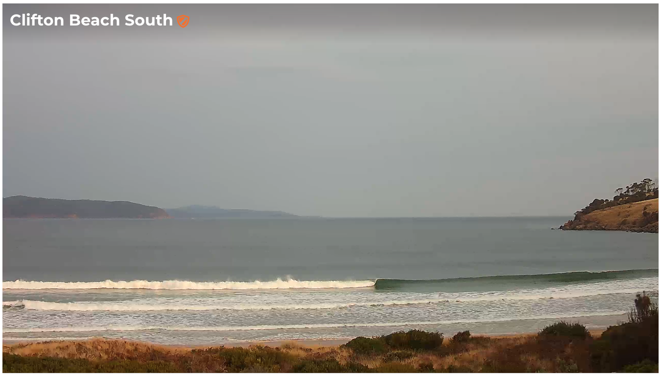
Great waves for the last few days with favourable winds and strong S/SW swells that didn’t abate quite as fast as expected in Monday's notes. Even now there are still occasional 2-3ft sets across exposed beaches (see surfcam grab from around 5:30pm). Tuesday managed 3-4ft sets throughout the day.

This week (Sep 14 - 15)
No major to the outlook for the rest of the week.
Surf size will bottom out into Thursday morning, and generally light winds tending N/NE will favour open beaches, but I’m not expecting much more than a slow 1-2ft.
Small long period energy is expected to show at the Cape Sorell buoy early on, but it’ll be very west in direction, and will have originated from our distant swell window, so I’m not expecting any size increase throughout the South Arm.
Similarly small swells will persist (and maybe ease) on Friday with winds becoming strong to gale force W/NW throughout the day. It won’t be very enticing, so make the most of Thursday at your favourite swell magnet.
This weekend (Sep 16 - 17)
There’s been a slight improvement in the weekend outlook, with the models strengthen a series of fronts through the Bight, and also pulling the storm track a little more towards the South Pole, which means it’ll have a little less west in the resulting swell direction than Monday’s notes were expecting.
That being said, we’ll see associated gale force W/NW thru W’ly winds for most of the weekend (locally) so even if we do see a swell increase at the coast, it’ll be very blustery.
Saturday looks to be undersized for most of the day. Sunday’s models are suggesting an increase into the 3ft mark but I’m highly skeptical on this projection as westerly swells rarely perform well inside Storm Bay. Given the accompanying poor weather conditions, I’d recommend leaving it for another day.
Next week (Sep 18 onwards)
The models have now cooled on the prospects of a stalled LWT below the continent next week, instead swinging towards a mobile frontal passage through the Southern Ocean.
There’s no suggestion for any major swell events through this period, but the end result is probably better anyway - it’s looking like we could have a steady supply of small swells throughout the South Arm all week - though with generally wintry frontal westerlies for the most part.
Let’s take a closer look on Friday, things have been moving around a bit of late and we are likely to have further revisions to evaluate in Friday’s update.
See you then!

