Another large swell to end off the week
Southern Tasmanian Surf Forecast by Craig Brokensha (issued Wednesday May 31st)
Best Days: Selected spots late tomorrow, Friday, Saturday morning, Sunday afternoon for the keen, Monday
Features of the Forecast (tl;dr)
- Large W/SW tending SW groundswell building tomorrow with gusty W/NW tending strong W/SW winds
- Large easing SW groundswell Fri with NW tending variable N/NE winds
- Easing swell Sat with N/NW tending W/NW then strong SW winds
- Moderate sized + S/SW groundswell Sun with fresh but easing S/SW-SW tending S/SE winds
- Easing surf Mon with N tending NE winds
Recap
The swell was still up and in the 2-3ft range through yesterday, back to 1-2ft today with fresher N'ly winds.
This week and next (Jun 1 – 9)
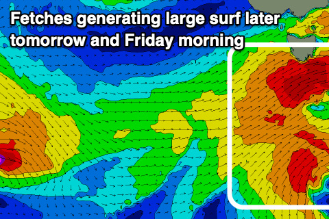
Looking at tomorrow and we've got a rapid and large increase in W/SW tending SW groundswell due across the South Arm as morning W/NW winds shift strong W/SW into the afternoon.
The source of this swell is a strong and healthy frontal progression that's moving in from the west, generating rolling fetches of gale-force W/SW winds.
As the progression moves across us tomorrow, a slightly stronger, SW fetched will be projected into the state, producing the most size into the afternoon.

The morning looks to come in at 2-3ft tomorrow, building to 6ft through the afternoon, then easing back from 4-5ft+ on Friday.
With the frontal system clearing to the east we'll see winds tending NW through the morning, variable N/NE into the afternoon at Clifton.
Saturday looks great as the swell eases further from 2ft to possibly 3ft along with N/NW offshore winds, shifting W/NW ahead of a strong SW change into the afternoon.
Now this change will be linked to a strong, tight polar low moving in from the west, clipping the state and bringing a renewal of moderate sized S/SW groundswell for Sunday morning.
A fetch of severe-gale W'ly winds should generate strong 4-5ft sets again across Clifton, but lingering, fresh SW-S/SW winds will create poor conditions, improving as winds ease and tend S/SE.
N tending fresh NE winds will be seen on Monday with easing surf from 2-3ft.
Longer term we're looking at a smaller run of surf through next week as a blocking high moves in from the west, but we'll have a closer look at this on Friday.

