Poor week, more action into next week
Southern Tasmanian Surf Forecast by Craig Brokensha (issued Monday August 15th)
Best Days: Beginners Wednesday, Friday and Saturday morning
Features of the Forecast (tl;dr)
- Easing SE swell tomorrow with a building, weak S/SW windswell
- Mod W tending strong SW-S/SW winds tomorrow
- Fading S/SW swell Wed with N tending NE winds
- Tiny W/SW swell Fri, easing from the SW Sat
- N/NW tending W/NW and W/SW Fri, similar Sat
Recap
A very dynamic weekend of weather and surf as a broad low moved this way and that, strengthening while bringing torrential rain.
Saturday was nice with variable winds and our new pulse of S'ly swell to 2-3ft, becoming bumpier through the mid-late afternoon.
Sunday was a write-off as strong to gale-force S/SE winds kicked in along with a junky increase in local windswell through the day.
This morning winds tended more variable with easing levels of SE swell from 2-3ft, though mostly for the keen with lump/bumpy conditions.
This week and weekend (Aug 16 - 21)
 Looking at the current synoptic setup and the broad low linked to the recent run of winds and swell is still sitting over us, but it'll shift back to the east during this evening, bringing in poor and strengthening W tending SW-S/SW winds tomorrow.
A weak, localised S/SW windswell to 2ft is due from this change, but early there should still be 2ft of leftover SE swell.
Wednesday will become cleaner but the surf tiny with N tending NE winds. Beginners may find a little wave in the AM.
After all this activity from our south-east, we can finally start looking back to the west for the rest of the period.
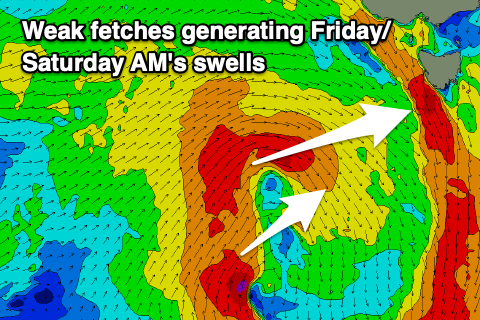
 A flurry of unfavourably aligned mid-latitude frontal activity isn't expected to generate any size late week, possibly coming in at 1-1.5ft Friday. Winds will be favourable though and N/NW tending W/NW then W/SW.
The weekend looks generally tiny with easing clean 1-1.5ft waves Saturday but into next week, some better, broader Southern Ocean frontal activity is due to fire up south of the country.
At this stage it doesn't look to be overly consolidated but still there are positive signs with fun pulses of W/SW swell energy due to build through the week with winds out of the western quadrant. More on this Wednesday when we can nail down some of the individual pulses and sizes.

