Plenty of surf over the coming days with good conditions
Southern Tasmanian Surf Forecast by Craig Brokensha (issued Monday July 18th)
Best Days: Tomorrow, Wednesday, Thursday, Friday morning
Features of the Forecast (tl;dr)
- Moderate sized S'ly swell easing tomorrow, with a reinforcing pulse of groundswell into the PM
- Light-mod W/NW tending weaker W/SW winds mid-PM
- Easing S swell Wed with N/NW tending E/NE winds
- Fun S/SW groundswell Thu AM, easing with N tending N/NE winds
- Fading surf Fri with fresh N/NE winds
Recap
Surf on the tiny to small side Saturday, clean and surfable on the right equipment, tiny into yesterday.
Today we've got a larger mix of swells in the water with onshore winds, 3-4ft this morning but bigger this afternoon and best in protected spots.
This week and weekend (Jul 19 - 24)
 The strong polar outbreak linked to today's large S/SW swell and low level snow is starting to clear to the east as a strong high muscles in from the west.
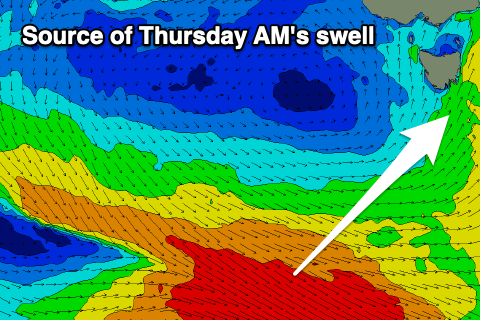
Under the high, a final polar front is generating a fetch of gale-force W/NW winds and this will generate a final pulse of S/SW groundswell for Thursday once the current swell eases over the coming days.
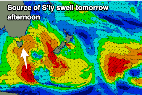
There'll be plenty of south energy still in the mix tomorrow, and a fetch of S'ly gales to the south-southeast of us this morning will produce a reinforcing pulse of moderate sized S'ly groundswell for tomorrow afternoon.
Size wise Clifton should be 3-4ft all day and winds will improve, tending light to moderate W/NW for the morning tomorrow and variable W/SW mid-late afternoon.
Wednesday looks cleaner with N/NW tending E/NE winds and easing 2-3ft sets.
 The reinforcing S/SW groundswell for Thursday should maintain less consistent 2-3ft waves through the morning, easing into the afternoon and with great N tending N/NE winds.
Make the most of the coming swell as we'll enter a slower period of surf until a strong progression of polar fronts fires up into the end of the month.
More on this Wednesday.

