Fun weekend of west swell
Southern Tasmanian Surf Forecast by Craig Brokensha (issued Friday June 24th)
Best Days: Saturday, Sunday morning, Monday and Tuesday morning for beginners
Features of the Forecast (tl;dr)
- Small-moderate sized W/SW swell for tomorrow and Sun AM, easing slowly into the PM
- N/NW winds tomorrow, fresh W/NW tending W/SW midday Sun
- Tiny levels of SW swell Mon and Tue AM
- W/NW winds Mon, N-N/NE on Tue
- Possible large S/SW groundswell late next week
Recap
Flat conditions yesterday and this morning but some new W/SW swell should be kicking with Cape Sorell now on the move.
This weekend and next week (Jun 25 – Jul 1)
Later today we should see some fun new mid-period W/SW swell filling in, generated by a couple of back to back mid-latitude fronts pushing east through our swell window.
 Size wise we should see surf to mostly 2ft across Clifton but there's the possibility of the odd 3ft set tomorrow, easing back from 2ft Sunday morning and then tiny into next week.
Conditions look great tomorrow with a persistent N/NW breeze, lighter into the afternoon. Sunday will be best early with a fresh W/NW breeze ahead of a W/SW change around midday.
Looking at Monday and a weak, trailing fetch of W/SW winds on the polar shelf during the weekend looks to maintain 1-1.5ft sets, easing from a similar size Tuesday.
W/NW breezes will create ideal conditions for beginners on Monday, with N/NE winds on Tuesday as the swell fades.
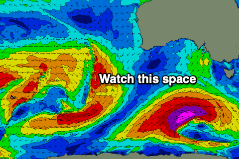
 From here there's nothing significant on the cards at all until Friday. And Friday looks significant with a strong polar low due to develop south-west of us, projecting a fetch of severe-gale to storm-force SW winds through our southern swell window.
This will generate a large S/SW groundswell for Friday, with some localised windswell in the mix under strong S/SW-SW winds.
Check back here on Monday for more information regarding this swell. Have a great weekend!

