Winds create issues
Southern Tasmanian Surf Forecast by Craig Brokensha (issued Wednesday March 2nd)
Best Days: Selected spots for the keen tomorrow morning and Monday
Features of the Forecast (tl;dr)
- Inconsistent mix of W/SW and SW groundswell tomorrow with moderate N/NE tending stronger E/NE-NE winds
- Fading swell Fri with fresh N/NE winds
- New W/SW groundswell Sun with a localised S windswell and strong S winds
- Mid-period SW swell Mon and Tue with gusty NE winds Mon, pre-dawn W/NW winds Tue ahead of a strong S change around dawn
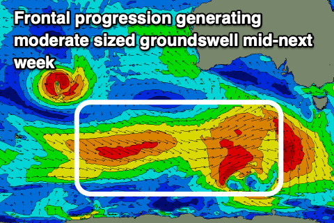
- Moderate sized W/SW groundswell building Tue, peaking Wed with S winds
Recap
The swell kicked a little through yesterday, with inconsistent sets into today but Clifton has been poor and choppy, with more exposed locations fairing better.
This week and next (Mar 3 - 11)
While the current swell has been inconsistent, tomorrow will be even less so, though a tiny reinforcing pulse of energy may pad out sets through the day. We should see an inconsistent W/SW groundswell from the earlier stages of the polar frontal progression linked to yesterday's and today's swell filling in with surf mostly to 1-1.5ft with the odd 2ft'er for the patient.
 Winds will continue to favour spots away from Clifton with a moderate N/NE offshore tomorrow morning, shifting E/NE-NE into the afternoon and strengthening.
Fresh N/NE winds will persist Friday with tiny levels of easing swell.
As we move into the weekend, Saturday will be tiny to flat with light NE tending SE winds ahead of a strong, evening S'ly change as a deepening trough/low moves across us.
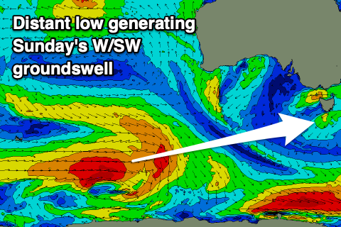
This will spoil a new W/SW groundswell that's currently being generated by a healthy polar low east of the Heard Island region.
The low will weaken while moving very slowly east over the coming days, generating weaker but fun levels of reinforcing mid-period SW swell for Monday and Tuesday.
 Size wise Sunday's swell looks to be 2ft+ but with those poor winds, with 2ft surf due Monday as winds shift back to the NE through the morning but fresh.
There might be a small window of W/NW winds on Tuesday morning ahead of another trough and S'ly change shortly after dawn.
This trough and a strong high trying to move in from the west during the week looks to maintain average S'ly winds through most of next week. This may spoil another swell, that being a moderate sized W/SW groundswell but more on this Friday.

