Fun swell pulses with workable winds
Southern Tasmanian Surf Forecast by Craig Brokensha (issued Monday February 14th)
Best Days: Tomorrow morning keen surfers, Wednesday, Friday morning, Saturday, Sunday morning
Features of the Forecast (tl;dr)
- Easing W/SW groundswell tomorrow with light S/SW tending S/SE winds
- Reinforcing mid-period W/SW swell Wed with N/NE-N tending light NE winds
- Building mix of swells Fri with moderate NW tending strong W/SW winds, easing Sat with W/NW tending E/SE winds
- Smaller Sun with N/NW tending SW winds
Recap
Clean, tiny 1-1.5ft waves on Saturday with a drop in swell from Friday, near flat on Sunday. Today has started tiny but some new swell is now filling in but with freshening S/SE breezes.
This week and weekend (Jan 15 - 20)
This afternoon’s building W/SW groundswell was generated by a strong polar low over the weekend and we should see sets reaching 2-3fty this afternoon, easing back from a similar size tomorrow morning.
A secondary weaker front pushing in behind the low today is generate a fetch of strong W/NW winds and this should produce a reinforcing mid-period W/SW swell for Wednesday to 2ft on the sets across Clifton.
 Winds now unfortunately look onshore from the S/SW tending S/SE tomorrow but only light in the morning, creating bumpy/lumpy conditions with Wednesday coming in cleaner with a N/NE-N offshore, tending lighter NE into the afternoon.
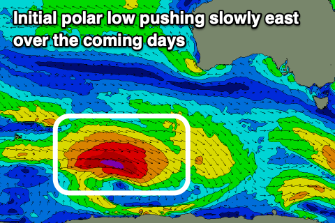
Moving into the end of the week, we’ve got some sizey groundswell on the way owing to a strong polar low that’s fired up east of Heard Island. A great fetch of severe-gale W/NW winds are being projected slowly east towards us, with the low due to weaken under the country on Wednesday.
This will produce an inconsistent, strong W/SW groundswell for Friday, building towards a peak into the afternoon.
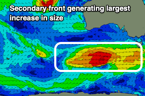
 At the same time a secondary strong polar front will race in on the back of the polar low and generate an additional fetch of W’ly gales, adding some additional W/SW swell to the mix Friday afternoon.
We should see Clifton building 3-4ft during the day along with moderate NW tending strong W/SW winds as the secondary front pushes through. Saturday looks fun as winds shift back to the W/NW as the swell eases from the 3ft range. Weak sea breezes are due into the afternoon.
Longer term, weaker trailing fronts will continue to generate plenty of small surf into next week but we’ll have a closer look at this on Wednesday.

