Tiny run of swell
Southern Tasmania Surf Forecast by Craig Brokensha (issued Wednesday 24th June)
Best Days: No good days, beginners tomorrow and Saturday morning
Recap
Poor and building levels of SE windswell yesterday with torrential rain, easing through today with lighter winds and cleaner conditions. The size is a bit under expectations, though spots more exposed to the south-east energy should be offering a bit more energy.
This week and weekend (Jun 25 - 28)
The current SE swell is on the ease as the stalling low linked to it has moved east and out of our swell window. This will result in the size fading tomorrow from a tiny 1ft+ with N/NW winds.
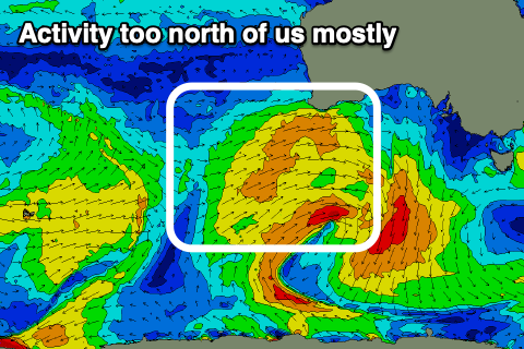
 Our next increase in swell will be a tiny and mid-period W/SW one, generated by a stalling mid-latitude that's currently south of WA. All the fetch is west and just within our swell window, with it weakening once pushing east tomorrow and Friday.
No size is due off this swell, with a possible 1ft+ wave on Saturday across Clifton with NW tending W/SW winds.
Longer term there's a bit more action on the cards with a strong node of the Long Wave Trough due to move in later next week. This will bring stormy activity though it might be with poor winds. More on this Friday.

