A mix of swells this week with some good days
Southern Tasmania Surf Forecast by Craig Brokensha (issued Monday 15th July)
Best Days: Wednesday morning, Thursday, Friday, Saturday
Recap
A window of clean waves to 2ft Saturday morning, bumpier and bigger into the afternoon with an onshore change, lumpy and 2-3ft Sunday morning. Some larger surf should have built into the afternoon and peaked this morning. Conditions weren't ideal but have since improved with a fresher offshore NW breeze.
Today’s Forecaster Notes are brought to you by Rip Curl
This week and weekend (Jul 16 – 21)
These notes will be brief as Ben’s on annual leave.
Today's swell is expected to ease back in size tomorrow, but a front pushing in and under us today will generate a new mid-period W/SW swell for tomorrow morning, swinging more SW in direction owing to a trailing fetch of strong SW winds behind it.
 Surf to 3ft is expected across Clifton, easing from 2-3ft Wednesday.
Winds will unfortunately be onshore from the W/SW tomorrow, better Wednesday and NW ahead of a gusty W/SW change early afternoon.
This change will be linked to another cold front moving across us kicking up a weak 2-3ft of mid-period SW swell for Thursday.
Winds will improve as a stronger frontal progression moves in from the west, bringing a W/NW tending N/NW breeze as the swell eases.
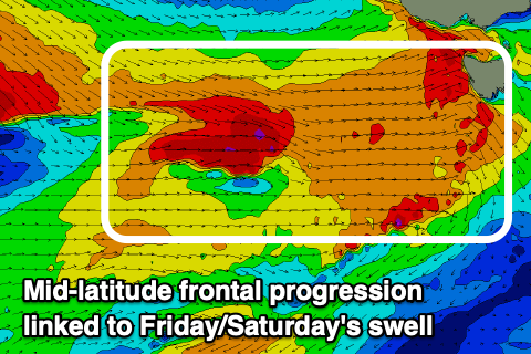
The mid-latitude frontal progression will strengthen while pushing across and under us, with a fetch of strong to gale-force W/SW winds moving through our western swell window, strongest while under us Friday.
This will produce a building mix of W/SW swells on Friday from 2-3ft in the morning to 3ft+ later but with gusty and easing W/NW winds. Saturday looks best with a N'ly offshore and easing swells 3ft.
Longer term we've got a good but west groundswell due mid-next week, but more on this Wednesday.

