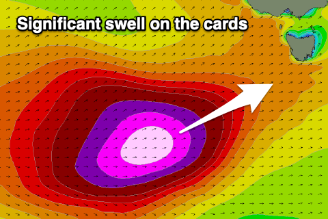
Small S'ly swell with a significant swell on the cards
Southern Tasmania Surf Forecast by Craig Brokensha (issued Monday 8th July)
Best Days: Tuesday, next week
Recap
Tiny waves for beginners on the weekend and this morning but nothing of substance for anyone else.
Today’s Forecaster Notes are brought to you by Rip Curl
This week and weekend (Jul 9 - 14)
Our small S'ly swell for tomorrow is still on track, with a late forming polar front to our south on the weekend generating a fetch of strong to gale-force S/SW winds, south of us.
A small 1-2ft wave is expected across Clifton tomorrow, fading Wednesday.
Winds tomorrow will be mostly NW, but we may see them tending W/NW for a short period late morning, N/NW all day Wednesday.
 The developments later in the week and into the weekend aren't ideal for us with a strengthening node of the Long Wave Trough forecast to move in across the south-east of the country.
All of the storm activity will be initially too north of us, but as the LWT moves further east into the Tasman Sea on the weekend, we're set to see a very significant storm generated in our swell window.
A very intense polar low is forecast to form south-west of WA on Friday, projecting a fetch of severe-gale to hurricane-force W/SW winds along the polar shelf in our swell window and then projecting north-east up and under us on Sunday evening and Monday.
A large, long-period and significant SW groundswell is expected off this storm with it filling in Monday and peaking around 6-8ft across Clifton if all holds steady. This will be along with strong W/SW winds, but we'll have a closer look at this Wednesday.

