Mostly onshore with swell this week, with a couple of windows
Southern Tasmania Surf Forecast by Craig Brokensha (issued Monday 27th May)
Best Days: Early Wednesday, protected spots Thursday arvo and Friday morning, Saturday morning
Recap
Saturday's swell didn't really offer much in the way of size with easing sets from 1-2ft with a light offshore wind, hanging in around a similar size on Sunday, though tiny today.
Today’s Forecaster Notes are brought to you by Rip Curl
This week and weekend (May 28 – Jun 2)
A strong cold front will produce a burst of strong to gale-force W/SW winds under us but only for 6-8hours max, not likely generating much over 1ft+ tomorrow morning with gusty W/NW winds.
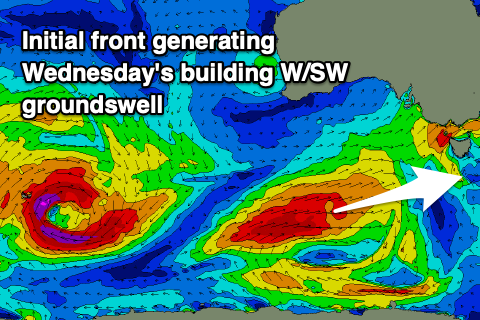
 The vigorous polar frontal progression that's currently forming to our east has changed quite a bit since Friday's forecast. We're still expecting the swell to come from the W/SW, but a strong and favourably aligned polar front that's currently south of WA will push up towards SA and out of our swell window.
We'll see a moderate sized W/SW groundswell from the initial stages of the front though, filling in Wednesday and building towards 3ft+ into the afternoon. Unfortunately the frontal progression will slide east on Wednesday with a dawn W/NW breeze due to swing SW mid-morning and S/SW into the afternoon, creating poor conditions as the swell builds.
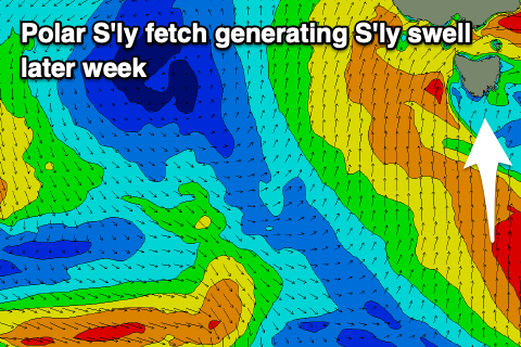
As the progression slides east though we'll see a great fetch of strong to gale-force S'ly winds projected up through our southern swell window on Wednesday, with a secondary fetch of strong S/SW winds on Thursday.
This will generate new levels of S'ly groundswell building Thursday afternoon, mixed in with mid-period S/SW swell. Size wise we're probably looking at a continuation of surf to 3ft+ Thursday, with 3-4ft sets on Friday morning, easing through the day.
 Winds will unfortunately remain onshore from the SW on Thursday, similar Friday creating average conditions.
Winds will finally swing back W/NW on Saturday morning as the S/SW swells ease back from a good 2-3ft.
Longer term a cold front pushing across and then up and past us on Sunday should generate a new building mid-period SW swell for the afternoon but with onshore winds, coming in at 3ft on Monday but with S/SW winds again.
It'll be a case of easing, and cleaner surf on the backside of the swell, but more on this Wednesday.

