A couple of fun swells ahead of larger surf next week
Southern Tasmania Surf Forecast by Craig Brokensha (issued Monday 1st April)
Best Days: Tuesday morning, Thursday morning, next week
Recap
A bit of swell but not the greatest conditions Saturday morning, while Sunday was cleaner though smaller.
Today a strong new swell has come in as expected with lumpy 3-4ft sets across Clifton, bumpy and smaller this afternoon.
Today’s Forecaster Notes are brought to you by Rip Curl
This week and weekend (Apr 2 - 7)
Today's strong SW tending S/SW swell should be starting to ease across Clifton and it will continue to drop tomorrow, tiny into Wednesday morning.
 Conditions will be much better tomorrow with an offshore N/NW breeze ahead of SE sea breezes and easing 2ft sets.
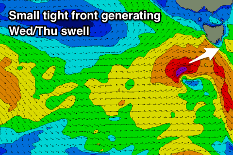
While Wednesday will start tiny, a small and tight front moving in from the west through the day will generate a burst of strong to near gale-force W/SW winds in our western swell window tomorrow evening and Wednesday morning.
A late pulse of W/SW swell is likely, but with onshore SW winds, with clean easing 2ft waves Thursday morning under a variable tending NE breeze, freshening into the afternoon.
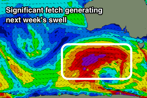
From here the outlook is tiny into the weekend, but into next week, a strong node of the Long Wave Trough is forecast to develop across WA and move east across us.
 This will result in strengthening Southern Ocean frontal systems, initially too north of our swell window ahead of a very broad, elongated fetch of severe-gale to storm-force W/SW winds stretching from the polar shelf south-west of WA to the Bight.
This frontal progression will move east before weakening, but we should see a moderate sized W/SW groundswell produced for next week, building Monday and peaking Tuesday in the 4ft range with NW to SW winds. Have a check back here on Wednesday for more details on this swell event.

