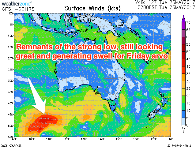
Good W/SW groundswell for later Friday
Southern Tasmania Surf Forecast by Craig Brokensha (issued Wednesday 24th May)
Best Days: Friday afternoon, Saturday morning, Tuesday morning
Recap
Fun easing 1-2ft sets out of the S/SE yesterday morning, near flat today.
This week and weekend (May 25 – 28)
Tiny surf will continue tomorrow, but our W/SW groundswell for Friday is looking a little better.
A tight and intense low in the Indian Ocean is now slowly weakening and positioned south of WA.
This system is aiming a good fetch of W/SW gales through our western swell window and will continue east over the coming days while slowly easing.
 The system should pass under us Thursday evening, but early Friday we're not likely to see much size above 1ft.
The groundswell proper should fill in through the day though, jumping to a good 2ft+ by dark, peaking overnight and easing back from 2ft Saturday morning.
Winds are looking good all day Friday with a W/NW tending variable NW breeze, while Saturday should see fresh N/NW winds all day.
Come Sunday there isn't due to be any size left at all.
Into early next week, a strong mid-latitude front moving in from the Bight over the weekend is due to broaden and stall slightly south-west of us Sunday.
We'll see a weakening fetch of polar S/SW winds generated in our southern swell window, producing a good S/SW swell for Monday afternoon/Tuesday morning. Sets to 2ft or so are likely, but winds look as if they'll be onshore Monday, back offshore Tuesday.
Following this a stronger cold outbreak is possible mid-week, but more on this Friday.

