Best Saturday, small windows from then onwards
Southern Tasmania Forecast (issued Friday 12th September)
Best Days: Saturday, Tuesday morning
Recap
Yesterday started off slow but into the afternoon a strong increase in W/SW swell was seen as winds remained favourable from the W/NW.
This morning was great with an easing 3ft of swell under persistent offshore N/NW winds.
This weekend and next week (Sep 13 - 19)
Today's swell should ease off through tomorrow but a reinforcing W/SW swell should keep 2ft+ waves hitting Clifton through most of the morning before tailing off into Sunday to 1-2ft.
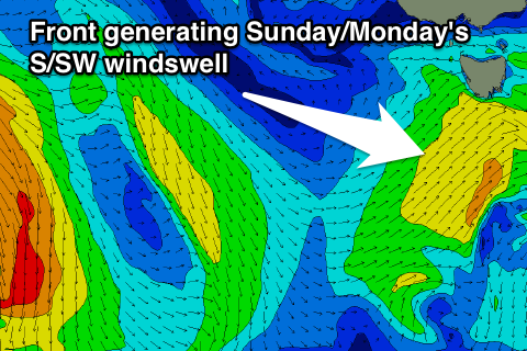
 Conditions should be good all day again with a NW tending W/NW breeze tomorrow while Sunday will see NW tending fresh SW winds as a deepening polar front pushes through.
This front should kick up a short-range S/SW swell for the afternoon and Monday to 2ft+ but with lingering onshore SW winds.
A drop in swell is due into Tuesday from 2ft or so from the S'th and winds will be much better and from the N/NW ahead of another W/SW change late in the day.
This change will be related to a funky trough moving across the state and we may see some fresh swell off this system later in the week, but the models are still divergent on how this system will develop. So check back here on Monday for the latest on this. In the meantime have a great weekend!

