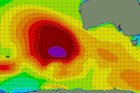
Tiny for the most part, biggest Thursday
Southern Tasmania Forecast (issued Monday 25th Aug)
Best Days: Thursday morning (but marginal)
Recap
The weekend started off tiny with 1ft of swell under N'ly winds. Sunday was even smaller, but a very late kick in long-range and inconsistent W/SW groundswell was seen to 1ft+. This swell has held into this morning and light N'ly winds continued to create clean conditions before weak S/SE breezes popped up into this afternoon.
This week (Aug 26 - 29)
Late yesterday's and today's tiny and inconsistent W/SW groundswell was generated by a vigorous storm in the Southern Indian Ocean, hence the tiny size.
 This swell should ease tomorrow but a tiny reinforcing W/SW groundswell from an unfavourable fetch of pre-frontal W/NW winds should keep 1ft waves hitting Clifton for beginners. The swell should fade through Wednesday from a tiny 0.5-1ft.
Into Thursday a secondary long-range W/SW groundswell from the Southern Indian Ocean is due, but the vigorous polar front generating this swell was situated a touch further south and more in our swell window.
As a result we should see a touch more size across our region with very inconsistent 1-2ft sets due across Clifton Thursday as it peaks. Winds should be favourable and light offshore before weak SE'ly breezes kick in after lunch.
This swell will fade into the end of the week as winds play out similar to Thursday.
This weekend onwards (Aug 30 onwards)
There's nothing major on the cards for the weekend besides tiny background levels of W/SW groundswell. Winds will remain favourable for exposed spots so it may be worth making a trip.
Longer term we may see some better swell mid-late next week, but we'll check this out again Wednesday.

