Easing E'ly swells and tricky winds ahead; long term has dynamic potential
South-east Queensland and Northern NSW Surf Forecast by Ben Matson (issued Friday 10th February)
Best Days: Sat/Sun: early mornings across open beaches and northern corners as the E'ly swell eases and winds swing N'ly. Tues: peaky combo of S'ly and S/SE swells, but a little wind affected in the Far North and SE Qld. Should be some small runners on the sand bottom points tho'. Next weekend onwards: plenty of potential for a decent E'ly groundswell.
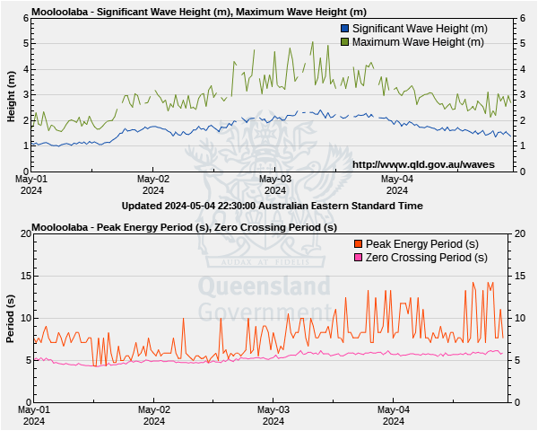
Recap: The trade swell built nicely through Thursday and into Friday, and seems to be reaching a peak now (or has just reached a peak) with set waves somewhere between 4ft and almost 6ft at exposed spots in SE Qld and Far Northern NSW. The Tweed and Gold Coast buoys are showing the most size across the region, and wave heights are smaller across the Mid North Coast around 3-5ft. Early light winds today are now around to a sea breeze.

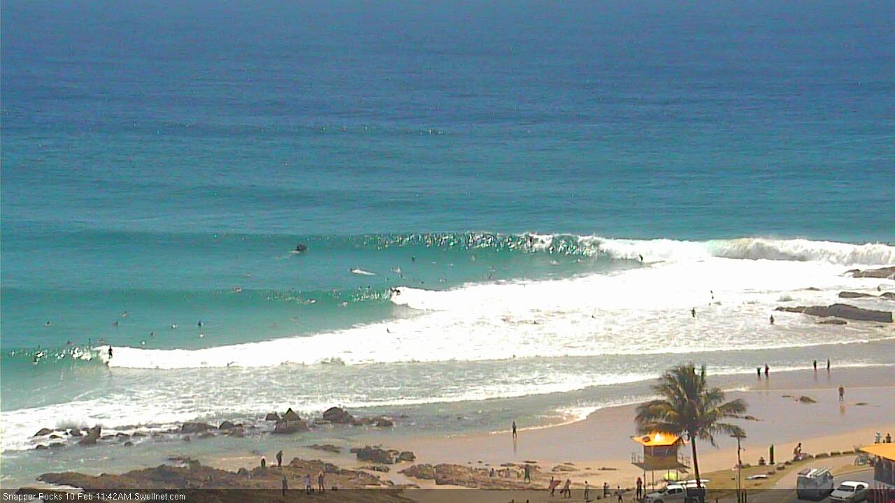
Snapper Rocks looking the goods around lunchtime today
This weekend (Feb 11th - 12th)
The primary source of today’s strong swell has largely eased throughout our swell window, and is pulling away to the east. As a result, we can expect a steady easing trend across all coasts from Saturday onwards.
As such, Saturday morning will see the most size of the next week or so. At this stage it’s still plausible for early 3-5ft sets at exposed beaches on the Sunshine Coast, with smaller 3-4ft surf on the Gold and Tweed Coasts and then incrementally smaller surf as you head south of Byron. Obviously, wave heights will be smaller across the points.
And it’ll become even smaller into Sunday. Our in-house surf model has 2ft for the Gold Coast but I think we’ll see a little more size than that - maybe some stray 2-3ft sets at first - but it will be noticeable smaller, weaker and less consistent than today’s punchy surf. Expect slightly smaller surf to the south.
The main consideration this weekend is the wind. Freshening northerlies will wipe out the points, and apart from an early period of NW winds both days you’ll have to head for the protected northern corners. Winds will be strongest across the Mid North Coast and lightest across the Sunshine Coast, with Sunday expected to see a little more strength overall.
So, Saturday morning is the pick of the forecast period.
Next week (Feb 13th onwards)
A reasonably strong front progression will kick up a solid south swell across Northern NSW through Monday afternoon (earlier on the Mid North Coast, may not reach the Far North Coast until overnight), peaking on Tuesday.
However, a weak trough moving up the Northern NSW coast overnight Sunday will anchor itself off the SE Qld coastline, driving gusty S/SE winds across most regions through Monday. And this is a more dominant influence on our surf prospects for the start of next week.
These winds will also kick up a short range S/SE swell for the region during Monday afternoon, though Far Northern NSW will become blown out so you’ll have to seek shelter across the protected points - and they’ll be quite small due to the swell direction and initial low period. Late afternoon may see some occasional 2ft runners across the semi-exposed points in SE Qld (south facing beaches will be bigger, but very wind affected); Tuesday will see the most size but it’s not really worth a day off work.
The building southerly groundswell should manage 4-5ft+ sets across Northern NSW’s south facing beaches on Tuesday, though we may see a lingering SE breeze (mainly across Far Northern NSW; the Mid North Coast should see early light variable winds). Expect smaller surf elsewhere. The swell direction won’t favour SE Qld so expect no major influence north of the border from this source. Easing size is expected from Wednesday morning onwards.
A stationary ridge through the Central/Northern Tasman Sea will then maintain small to moderate SE swells though the middle to latter part of the week. Surf size will remain pretty small across SE Qld but winds will be SE, so hopefully the sand bottom points should offer a few small peelers at times. Otherwise aim for the morning sessions across Northern NSW whilst the winds are a little lighter.
Looking further out and as speculated in the last few notes, we have some dynamic tropical activity across the Solomons mid-next week that’s currently modelled to converge south of Fiji later next week which could be result in the development of a major E'ly groundswell for our region either next weekend or early the following week. More on that in Monday’s notes.


Comments
somewhat messy, but uncrowded and a fair few BOMBS went off on the sunny coast beacjies, YEEEEWWW
The swell was pretty consistent today on the sunny coast . Hoping the morning brings light winds.
The swell was pretty consistent today on the sunny coast . Hoping the morning brings light winds.
Sunshine Coast was terrible this arvo.
Gold Coast looked heaps better and will be Saturday for sure
Yes. Everyone report to Snapper at 5am Saturday ;)
This morning felt the biggest of this run. Maybe due to it cleaning u a bit and the period just bumping up a notch. Solid 3-5ft everywhere once the morning sickness departed. Doesn't look like slowing down too quickly either.

Please.....make it stop
Was really consistent first up on sunny coast and only subdued slightly once tide came in but really good waves to be had .
Thermal Ben do you think there will still be at least 2 to 3 foot in the morning tomorrow on sunny coast
No alsurf it will be 18 inches and onshore/northerly !
Go to the Gold Coast, it will be firing and plenty of room for you.
Long range charts are looking tasty
They certainly are!
http://metvuw.com/forecast/forecast1.php?type=rain®ion=swp&tim=228
Long range looks super stoked, stay on target stay on target
The Wams from 21st on.....fuckn hell ....what a synoptic